Cunningham Road, Bangalore
Map

Map

Facts and practical information
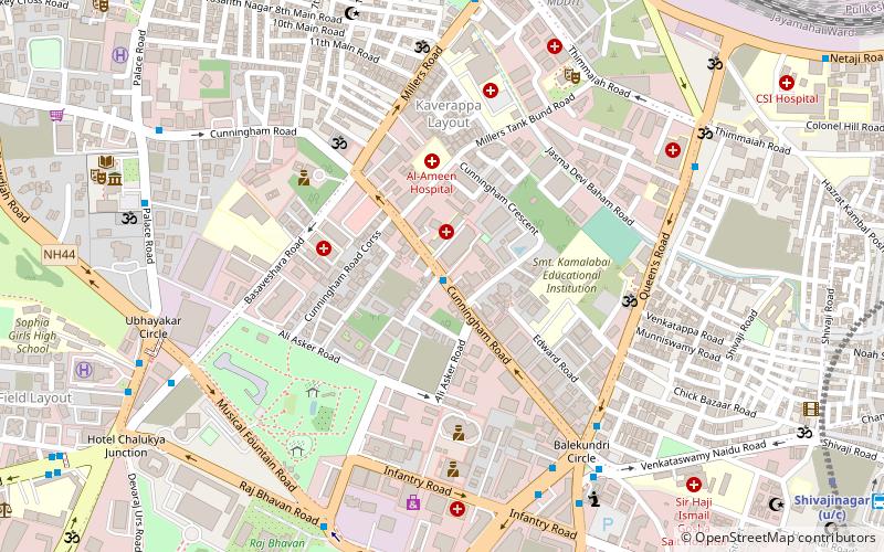
Cunningham Road is one of the busiest commercial streets of Bangalore, the state capital of Karnataka, India. It is located in the Vasanthnagar area of the city. The road is named after Francis Cunningham, who was an officer in the Madras Army and a member of the Mysore Commission. The road was also called Sampangi Ramaswamy Temple Road for some time. ()
Coordinates: 12°59'16"N, 77°35'40"E
Address
Vasanth NagarBangalore
ContactAdd
Social media
Add
Day trips
Cunningham Road – popular in the area (distance from the attraction)
Nearby attractions include: Visvesvaraya Industrial and Technological Museum, Commercial Street, Karnataka Government Museum, M Chinnaswamy Stadium.
Frequently Asked Questions (FAQ)
Which popular attractions are close to Cunningham Road?
Nearby attractions include National Military Memorial, Bangalore (7 min walk), Jawaharlal Nehru Planetarium, Bangalore (10 min walk), Raj Bhavan, Bangalore (11 min walk), NGMA, Bangalore (12 min walk).
How to get to Cunningham Road by public transport?
The nearest stations to Cunningham Road:
Bus
Train
Metro
Bus
- Cunningham Road • Lines: 107C, 119, 144K, 197, 290, 290A, 290B, 290C, 292, 292B, 293C, 293E, 294B, 300E, 302, 302G, 303F, 92E, K1, Mbs14 (1 min walk)
- Indian Express • Lines: 100, 107C, 119, 144K, 169, 197, 290, 290A, 290B, 290C, 290D, 292, 292B, 293C, 293E, 294B, 300E, 302, 302G, 303F, 74, 79B, 79G, 92E, Mbs14, Tr7 (8 min walk)
Train
- Bangalore Cantonment (13 min walk)
Metro
- Cubbon Park • Lines: Purple (14 min walk)
- Dr. B R Ambedkar Station, Vidhana Soudha • Lines: Purple (17 min walk)


