Govindpuri, Delhi
Map
Facts and practical information
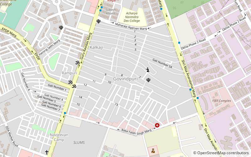
Govindpuri is a colony in South East Delhi. It is recreated on top of an old graveyard and is surrounded by Kalkaji, Chittaranjan Park, and Tughlakabad. The Violet Line of the Delhi Metro passes through the area and has a metro station by the name, Govindpuri. Govindpuri is supposedly reformed on a small hill, which was previously part of a cemetery. ()
Coordinates: 28°32'7"N, 77°15'50"E
Address
South Delhi (Kalkaji)Delhi
ContactAdd
Social media
Add
Getting there by public transportation
Public transportation stops near this location
- Metro
- Bus
 Metro
Metro
- Calculate routeKalkaji Depot 9 min walk
- Calculate routeC Lal Chowk 8 min walk
- Calculate routeGovindpuri 8 min walk
- Calculate routeGovind Puri 17 min walk
- Calculate routeHarkesh Nagar Okhla 24 min walk
- Calculate routeNehru Enclave 27 min walk
- Calculate routeKalkaji Mandir 28 min walk
Maps Metro
Metro
MetroDay trips


Frequently Asked Questions (FAQ)
How to get to Govindpuri by public transport?
The nearest stations to Govindpuri:
Bus
Metro
Bus
- Kalkaji Depot • Lines: (-) Oms, (+) Oms, 411, 433, 47A, 511A, 874, 8A, F-403A (9 min walk)
- C Lal Chowk • Lines: (-) Oms, (+) Oms, 411, 433, 511A, 774, 874, 8A, F-403A (8 min walk)
Metro
- Govind Puri • Lines: Violet Line (17 min walk)
- Harkesh Nagar Okhla • Lines: Violet Line (24 min walk)