Sugarloaf

Gallery (1)
Map
Map
Facts and practical information
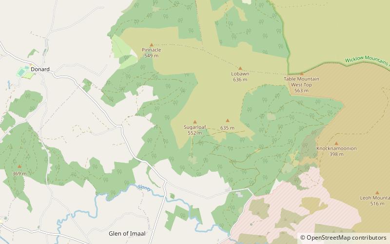
Sugarloaf is a 552 metres peak in west Wicklow, Ireland that lies on the northern edge of the Glen of Imaal. With a prominence of only 14 metres, it is not listed in any of the recognised categories of mountains in Ireland, and is a subsidiary summit of Lobawn 636 metres, to the north. ()
Elevation: 935 ftProminence: 46 ftCoordinates: 53°0'40"N, 6°33'30"W
Location
Wicklow
ContactAdd
Social media
Add
Day trips