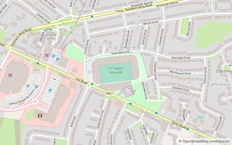
Gaelic Grounds, Limerick
Map
Facts and practical information
The Gaelic Grounds, know for sponsorshop reasons as the TUS Gaelic Grounds, is the principal GAA stadium in the Irish city of Limerick, home to the Limerick hurling and football teams. It has a capacity of 44,023. ()
Address
Ennis RoadLimerick
ContactAdd
Social media
Add
Getting there by public transportation
Public transportation stops near this location
- Bus
 Bus
Bus
- Calculate routeIrish Citylink, Henry Street 29 min walk
- Calculate routeLime Tree/Mary I 31 min walk
- Calculate routeArthur's Quay 31 min walk
Day trips


Frequently Asked Questions (FAQ)
Which popular attractions are close to Gaelic Grounds?
Nearby attractions include Limerick Institute of Technology, Limerick (11 min walk), Thomond Park, Limerick (15 min walk), Kilrush Church, Limerick (17 min walk), Ballynanty, Limerick (18 min walk).
How to get to Gaelic Grounds by public transport?
The nearest stations to Gaelic Grounds:
Bus
Bus
- Irish Citylink, Henry Street • Lines: Express to Cork, Express to Galway (29 min walk)
- Lime Tree/Mary I • Lines: 735 (31 min walk)