Aghla Beg
#526 among destinations in Ireland


Facts and practical information
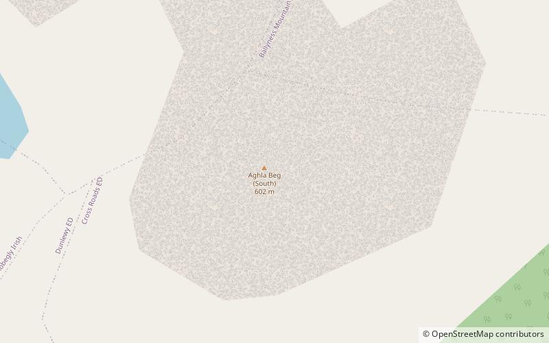
Aghla Beg is a mountain in County Donegal, Ireland. Of its two summits, one has a height of 564 metres, and the other, Aghla Beg South Top 602 metres. ()
DonegalIreland
Aghla Beg – popular in the area (distance from the attraction)
Nearby attractions include: Mount Errigal, Glenveagh Castle, Muckish, Lough Beagh.
 Natural attraction, Mountain, Hiking trail Natural attraction, Mountain, Hiking trail- Mount Errigal- 86 min walk • Mount Errigal, the tallest peak of the Derryveagh Mountains in County Donegal, Ireland, is an iconic symbol of natural beauty and Irish heritage. This quartzite giant, standing at an impressive height of 751 meters (2,464 feet), is not only the highest mountain in... 
 Forts and castles, History museum, Museum Forts and castles, History museum, Museum- Glenveagh Castle, Glenveagh National Park- 109 min walk • Glenveagh Castle is a large castellated mansion located in Glenveagh National Park, County Donegal, Ireland and was built in about 1870. 
 Natural attraction, Mountain, Park Natural attraction, Mountain, Park- Muckish- 89 min walk • Muckish is a distinctive flat-topped mountain in the Derryveagh Mountains of County Donegal, Ireland. At 667.1 metres, it is the third-highest peak in the Derryveagh Mountains and the 163rd highest in Ireland. 
 Nature, Natural attraction, Lake Nature, Natural attraction, Lake- Lough Beagh, Glenveagh National Park- 102 min walk • Lough Beagh, also known as Lough Veagh, is a freshwater lake in the northwest of Ireland. It is located in north County Donegal and is part of Glenveagh National Park. 
 Nature, Natural attraction, Mountain Nature, Natural attraction, Mountain- Mackoght- 65 min walk • Mackoght or Macoght, also called Little Errigal or Wee Errigal, is a 555 metres tall mountain in County Donegal, Ireland. 
 Neighbourhood Neighbourhood- Cloughaneely, Falcarragh- 122 min walk • Cloughaneely is a district in the west of County Donegal, Ireland. This is a mainly coastal area with a population of over 4,000 centred on the towns of Falcarragh and Gortahork. 
 Nature, Natural attraction, Lake Nature, Natural attraction, Lake- Gartan Lough- 194 min walk • Gartan Lough, also known as Lough Beagh South, is a freshwater lake in the northwest of Ireland. It is located in north County Donegal close to the eastern boundary of Glenveagh National Park. 
 Nature, Natural attraction, Lake Nature, Natural attraction, Lake- Lough Nacung Upper- 135 min walk • Lough Nacung Upper, also known as Upper Lough Nacung, is a lough in Gaoth Dobhair, a district in the north-west of County Donegal in Ulster, the northern province in Ireland. 
 Archaeological site Archaeological site- Ray Church- 139 min walk • Ray Church is a medieval church and National Monument in County Donegal, Ireland. 
 Nature, Natural attraction, Mountain Nature, Natural attraction, Mountain- Derryveagh Mountains, Glenveagh National Park- 93 min walk • The Derryveagh Mountains are the major mountain range in County Donegal, Ireland. It makes up much of the landmass of the county and is the area of Ireland with the lowest population density. 
 Nature, Natural attraction, Mountain Nature, Natural attraction, Mountain- Aghla More- 30 min walk • Aghla More is a mountain in County Donegal, Ireland with a height of 581 metres. 
