Mount Yumiori, Chūbu-Sangaku National Park
#11 among attractions in Chūbu-Sangaku National Park
Facts and practical information
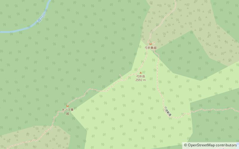
Mount Yumiori is a mountain located in the city of Takayama, Gifu, Japan. It is 2,592 m tall and part of the Hida Mountains. ()
Chūbu-Sangaku National Park Japan
Mount Yumiori – popular in the area (distance from the attraction)
Nearby attractions include: Mount Hotakadake, Mount Washiba, Mount Yari, Mount Suisho.
5.1 miSENatural attraction, Park, MountainMount Hotakadake, Kamikochi
131 min walk • Mount Hotaka, also known as Mount Hotakadake, is one of the 100 Famous Japanese Mountains as coined by the media, reaching a height of 3,190 m.
3.7 miNMountainMount Washiba
96 min walk • Mount Washiba, Japan, stands as a testament to the serene and rugged beauty of the Japanese Alps. This peak, located in the Chubu region, is part of the Northern Alps and offers a challenging yet rewarding experience for hikers and mountaineers.
3 miENature, Natural attraction, MountainMount Yari, Chūbu-Sangaku National Park
77 min walk • Mount Yari is one of the 100 Famous Japanese Mountains. The 3,180-metre-high peak lies in the southern part of the Hida Mountains of Japan, on the border of Ōmachi and Matsumoto in Nagano Prefecture and Takayama in Gifu Prefecture.
5.3 miNMountainMount Suisho
136 min walk • Mount Suisho, often referred to as the "Diamond Mountains," is a stunning peak located in the Northern Japanese Alps. Known for its rugged landscape and crystalline features that glimmer like a diamond under the sunlight, Mount Suisho reaches an impressive elevation of...
3.2 miSENature, Natural attraction, MountainMount Naka, Chūbu-Sangaku National Park
82 min walk • Mount Naka is a mountain with an altitude of 3,084m located in the southern part of the Hida Mountains, which straddles Matsumoto in Nagano Prefecture and Takayama in Gifu Prefecture. This mountain is located in Chūbu-Sangaku National Park.
4.3 miNWNature, Natural attraction, MountainMount Kurobegorō, Chūbu-Sangaku National Park
109 min walk • Mount Kurobegorō is one of the 100 Famous Japanese Mountains, reaching the height of 2,839.58 m. It is situated in Japan's Hida Mountains in Gifu Prefecture and Toyama Prefecture. It was specified for Chūbu-Sangaku National Park on December 4, 1934.
5.1 miSAerial tramwayShinhotaka Ropeway, Kamikochi
131 min walk • The Shinhotaka Ropeway is an aerial lift system in Takayama, Gifu Prefecture, Japan, and is operated by Okuhi Sightseeing Development. The Meitetsu Group company also operates hotels in the area. Opened in 1970, the line climbs to the hillside of the Hida Mountains' Mount Hotaka, the third tallest mountain in Japan.
2.7 miSENature, Natural attraction, MountainMount Kasa, Chūbu-Sangaku National Park
68 min walk • Mount Kasa is one of the 100 Famous Japanese Mountains, reaching the height of 2,897 m. It is situated in Japan's Hida Mountains in Gifu Prefecture and in Chūbu-Sangaku National Park. The shape of the mountain looks like the Umbrella in the triangle. Therefore, it became this name.
3 miENature, Natural attraction, MountainMount Obami, Chūbu-Sangaku National Park
77 min walk • Mt. Ookure is a 3,101 m high mountain located in the southern part of the Hida Mountains straddling Matsumoto City in Nagano Prefecture and Takayama City in Gifu Prefecture, facing the south side of Mt. Yarigatake.
5.2 miSENature, Natural attraction, MountainAinodake, Kamikochi
132 min walk • Mt. Manodake is a small peak in the Hotaka mountain range in the Northern Alps between Mt. The traverse route connecting Mt. Nishihotaka and Okuhotaka is said to be the most dangerous and difficult trail in Japan for ordinary climbers, and Mt.