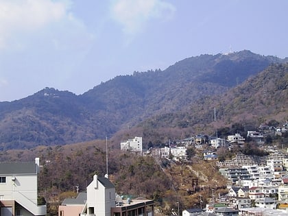
Maya Ropeway, Kobe
Map

Map

Facts and practical information
The Maya Ropeway is Japanese aerial lift line in Kōbe, Hyōgo, operated by Kōbe City Urban Development. Together with Maya Cablecar, the line has an official nickname Maya View Line Yume-Sanpo. Opened in 1955, the line climbs Mount Maya, with a scenic view of the city known as Kikuseidai. ()
Day trips
Maya Ropeway – popular in the area (distance from the attraction)
Nearby attractions include: Kikuseidai, Tenjō-ji, Mount Maya, Mount Nagamine.
Frequently Asked Questions (FAQ)
Which popular attractions are close to Maya Ropeway?
Nearby attractions include Kikuseidai, Kobe (2 min walk), Tenjō-ji, Kobe (11 min walk), Mount Nagamine, Kobe (21 min walk).
How to get to Maya Ropeway by public transport?
The nearest stations to Maya Ropeway:
Train
Bus
Train
- Hoshi (1 min walk)
- Niji (14 min walk)
Bus
- 摩耶ロープウェイ山上駅 • Lines: 六甲線(阪急六甲~六甲山頂~摩耶ロープウェイ山上駅) (2 min walk)
- 摩耶山天上寺前 • Lines: 六甲線(阪急六甲~六甲山頂~摩耶ロープウェイ山上駅) (11 min walk)


