Ngauranga Gorge, Wellington
Map
Facts and practical information
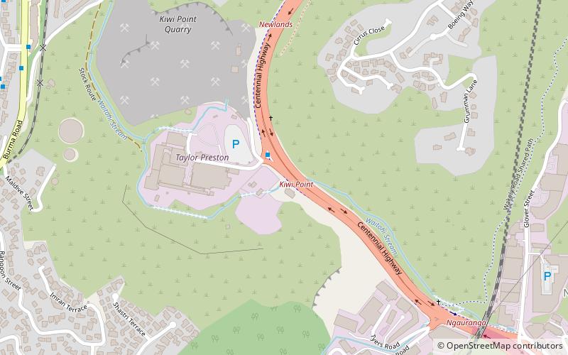
The Ngauranga Gorge is in the Wellington Region of New Zealand. State Highway 1 runs through the gorge, a vital link between central Wellington City and its northern suburbs and Porirua City and the Kapiti Coast; it is the main route north out of Wellington. It is 2 kilometres long and has a grade of approximately 8 percent. Sixty-five thousand vehicles a day travel through it, and it connects the Wellington Urban Motorway with the Johnsonville–Porirua Motorway. ()
Coordinates: 41°14'20"S, 174°48'22"E
Address
Onslow-Western Ward (Ngauranga)Wellington
ContactAdd
Social media
Add
Getting there by public transportation
Public transportation stops near this location
- Train
 Train
Train
- Calculate routeRaroa 14 min walk
- Calculate routeKhandallah 19 min walk
- Calculate routeNgauranga 20 min walk
- Calculate routeBox Hill 27 min walk
Day trips
Frequently Asked Questions (FAQ)
How to get to Ngauranga Gorge by public transport?
The nearest stations to Ngauranga Gorge:
Train
Train
- Raroa (14 min walk)
- Khandallah (19 min walk)