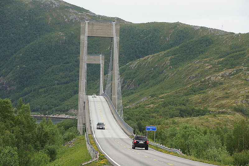
Kjellingstraumen Bridge

Gallery (2)
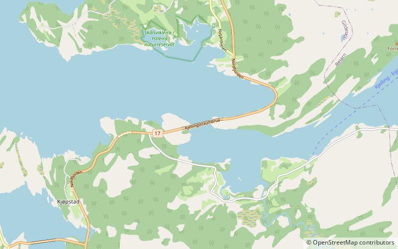
Map
Map
Gallery
Facts and practical information
The Kjellingstraumen Bridge is a suspension bridge that crosses the Kjellingsundet strait at the mouth of the Beiar Fjord in Gildeskål Municipality in Nordland county, Norway. The 662-metre long bridge carries Norwegian County Road 17. The bridge was opened in 1975 and the longest span is 260 metres. ()
Local name: Kjellingstraumen bru Opened: 1975 (51 years ago)Length: 2172 ftCoordinates: 67°4'42"N, 14°18'5"E
Location
Nordland
ContactAdd
Social media
Add
Day trips