Bøler, Oslo
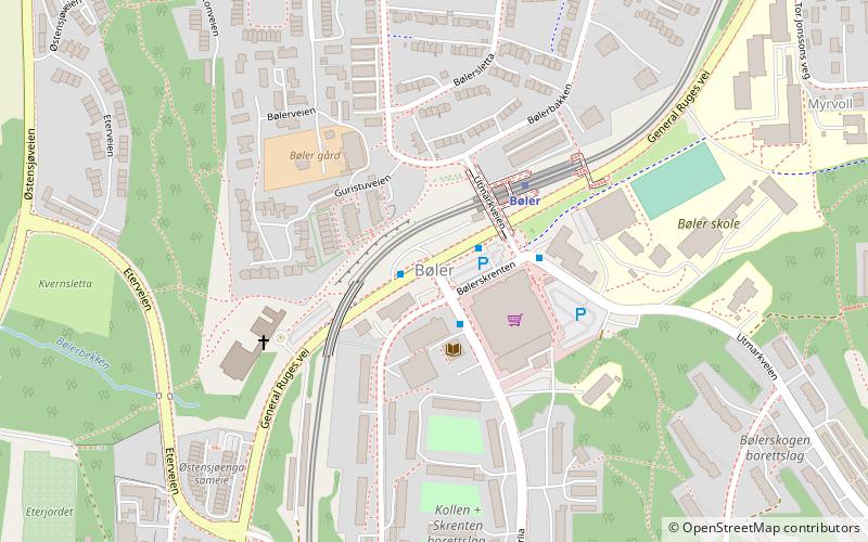
Map
Facts and practical information
Bøler is a south-eastern suburb of Oslo, Norway. It is one of the more picturesque areas of Oslo. Østmarka forest and lake Nøklevann are in its immediate vicinity. Infrastructure-wise, it has a shopping center, two elementary schools, a public bath, a library, a church and a stop on the Østensjøbanen metro line. ()
Address
Østensjø (Bøler)Oslo
ContactAdd
Social media
Add
Getting there by public transportation
Public transportation stops near this location
- Metro
- Bus
 Metro
Metro
- Calculate routeBøler 3 min walk
- Calculate routeUlsrud 12 min walk
- Calculate routeBogerud 13 min walk
- Calculate routeOppsal 18 min walk
- Calculate routeSkullerud T 30 min walk
Day trips


Frequently Asked Questions (FAQ)
Which popular attractions are close to Bøler?
Nearby attractions include Bogerud, Oslo (12 min walk), Østensjø, Oslo (14 min walk), Ulsrud, Oslo (16 min walk), Østensjøvannet, Oslo (16 min walk).
How to get to Bøler by public transport?
The nearest stations to Bøler:
Metro
Bus
Metro
- Bøler (3 min walk)
- Ulsrud (12 min walk)
Bus
- Skullerud T (30 min walk)