Quellorjo
#600 among destinations in Peru
![Quellorjo location map](https://tzmedia.b-cdn.net/media/images/static-maps/pe/-13_22_-72_2672.jpg)
Facts and practical information
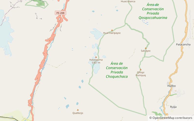
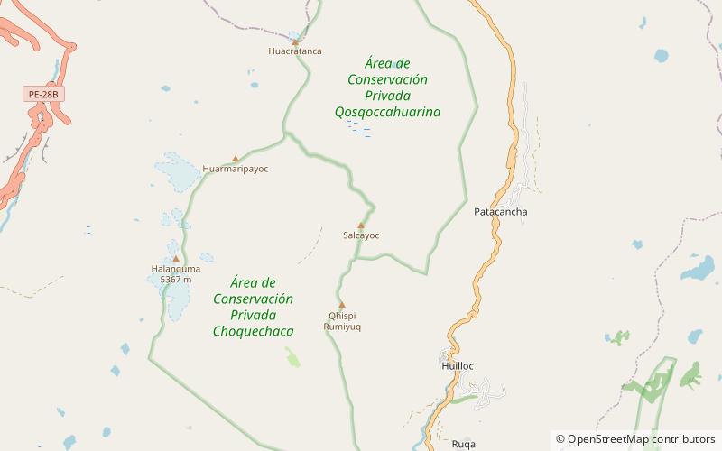
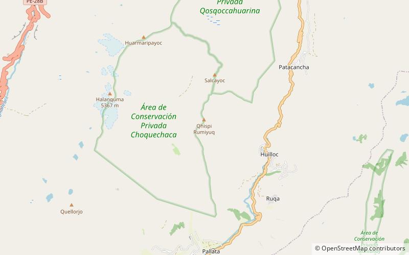
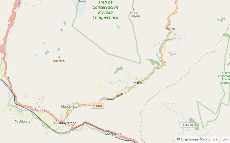
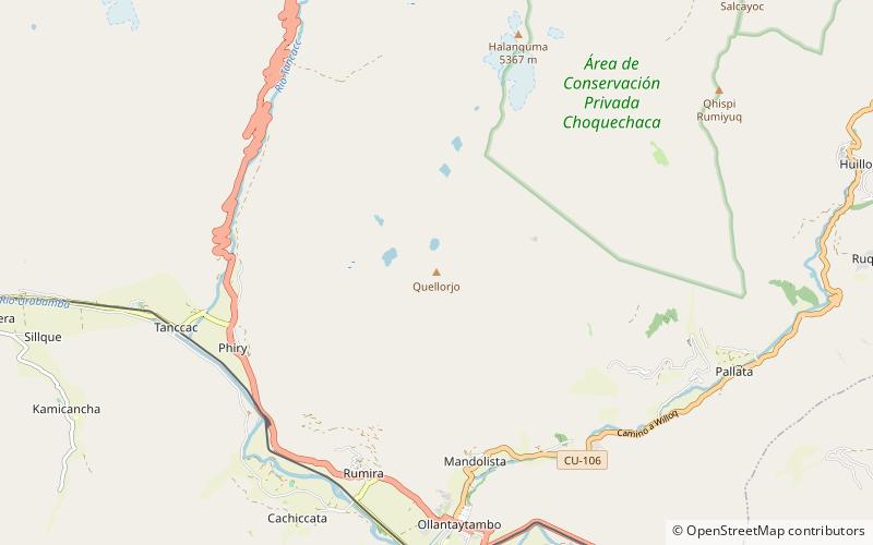
Quellorjo is a mountain in the Urubamba mountain range in the Andes of Peru, about 4,600 m high. It is located in the Cusco Region, Urubamba Province, Ollantaytambo District, northwest of Ollantaytambo. It lies southwest of Yurac Orjo. ()
CuscoPeru
Quellorjo plan & book
Unleash the traveler in you — discover the cheapest flight deals, find the perfect hotel or hostel nearby, and search for the best car rental prices. Travel at your own pace to discover new places and enjoy your journey.
Quellorjo – popular in the area (distance from the attraction)
Nearby attractions include: Inca Trail to Machu Picchu, Pinkuylluna, Veronica Mountain, Halancoma.
2.6 miSCity tours, Cultural tours, Walking toursInca Trail to Machu Picchu, Ollantaytambo
68 min walk • The Inca Trail to Machu Picchu is an iconic trek that takes adventurers through the heart of the Peruvian Andes, ending at the awe-inspiring archaeological site of Machu Picchu. This ancient pathway, a testament to Inca engineering, stretches over 40 kilometers through...
2.6 miSArchaeological sitePinkuylluna, Ollantaytambo
67 min walk • Pinkuylluna or Pinkulluna is an archaeological site on a mountain of the same name in Peru located in the Cusco Region, Urubamba Province, Ollantaytambo District. It is situated between the rivers Patakancha and Willkanuta, northeast of the town Ollantaytambo.
5.5 miNWNature, Natural attraction, MountainVeronica Mountain
142 min walk • Veronica, also called Huacrahuilki, Huacay Huilcay, Wayna Willka, Waqaywillka, Urubamba, or Padre Eterno, is a 5,893 m mountain in the Urubamba mountain range in the Andes of Peru.
2.5 miNNatural attraction, MountainHalancoma, Patacancha
65 min walk • Halancoma or Helancoma is a mountain in the Urubamba range in the Andes of Peru. Its peak is at 5,367 m m high. It is located above the town of Ollantaytambo in Urubamba Province, within the region of Cusco.
4.1 miNENatural attraction, MountainHuarmaripayoc, Patacancha
106 min walk • Huarmaripayoc is a mountain in the Urubamba mountain range in the Andes of Peru, about 5,000 m high. It is located in the Cusco Region, Urubamba Province, Ollantaytambo District. It lies southwest of Patacancha and northwest of Salcayoc.
4.5 miSWNature, Natural attraction, MountainYana Urqu
114 min walk • Yana Urqu is a 4,460-metre-high mountain in the eastern extensions of the Willkapampa mountain range in the Andes of Peru. It is located in the Cusco Region, Urubamba Province, Ollantaytambo District, southwest of Ollantaytambo.
4.4 miNENatural attraction, MountainSalcayoc, Patacancha
112 min walk • Salcayoc is a 4,838-metre-high mountain in the Urubamba mountain range in the Andes of Peru. It is located in the Cusco Region, Urubamba Province, Ollantaytambo District.
3.5 miNENatural attraction, MountainQhispi Rumiyuq, Patacancha
89 min walk • Qhispi Rumiyuq is a mountain in the Cusco Region in Peru, about 4,600 m high. It is situated in the Urubamba Province, Ollantaytambo District, northeast of Ollantaytambo.
5.8 miNENatural attraction, MountainHuacratanca, Patacancha
149 min walk • Huacratanca is a 5,024-metre-high mountain in the Urubamba mountain range in the Andes of Peru. It is located in the Cusco Region, Urubamba Province, Ollantaytambo District. It lies northwest of Salcayoc and Patacancha, and northeast of Huarmaripayoc.
2.3 miEArchaeological sitePumamarka, Patacancha
59 min walk • Pumamarka is an archaeological site in Peru. It is located in the Cusco Region, Urubamba Province, Ollantaytambo District, at the confluence of the rivers Patakancha and its affluent Yuraqmayu.