Polytechnic University of the Philippines, Manila
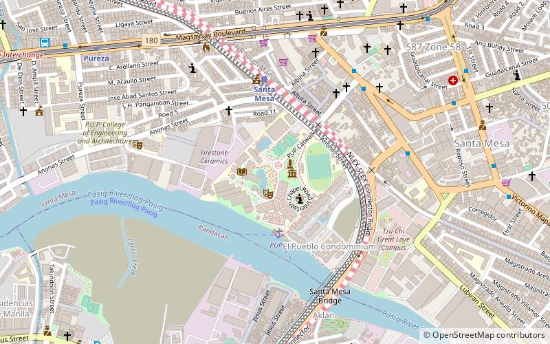
Map
Facts and practical information
Polytechnic University of the Philippines is a research and coeducational state university in the Philippines. It was founded on 19 October 1904, as the Manila Business School and as part of Manila's public school system. It was eventually promoted to chartered state university in 1978, by virtue of Presidential Decree 1341. PUP has more than 20 campuses and extensions across Central Luzón, Southern Luzón and Metro Manila. With over 70,000 enrolled students, PUP claims to be the largest state university in the Philippines by student population. ()
Getting there by public transportation
Public transportation stops near this location
- Metro
- Bus
- Train
- Ferry
 Metro
Metro
- Calculate routePup 4 min walk
- Calculate routeLambingan 23 min walk
- Calculate routeSanta Ana 28 min walk
- Calculate routeSanta Mesa 5 min walk
- Calculate routePandacan 14 min walk
- Calculate routeEspaña 35 min walk
- Calculate routeTeresa 7 min walk
- Calculate routePaco-Santa Mesa Road 8 min walk
- Calculate routeOld Santa Mesa 8 min walk
- Calculate routeV. Mapa 12 min walk
- Calculate routePureza 12 min walk
- Calculate routeV. Mapa 16 min walk
- Calculate routeJ. Ruiz 35 min walk
Day trips


Frequently Asked Questions (FAQ)
Which popular attractions are close to Polytechnic University of the Philippines?
Nearby attractions include Mabini Shrine, Manila (1 min walk), Ninoy Aquino Library and Learning Resources Center, Manila (2 min walk), Magsaysay Boulevard, Manila (8 min walk), Pandacan, Manila (10 min walk).
How to get to Polytechnic University of the Philippines by public transport?
The nearest stations to Polytechnic University of the Philippines:
Ferry
Train
Bus
Metro
Ferry
- Pup • Lines: Pasig River Ferry (4 min walk)
- Lambingan • Lines: Pasig River Ferry (23 min walk)
Train
- Santa Mesa (5 min walk)
- Pandacan (14 min walk)
Bus
- Teresa • Lines: 307 (7 min walk)
- Paco-Santa Mesa Road • Lines: 307, T393 (8 min walk)
Metro
- Pureza • Lines: 2 (12 min walk)
- V. Mapa • Lines: 2 (16 min walk)