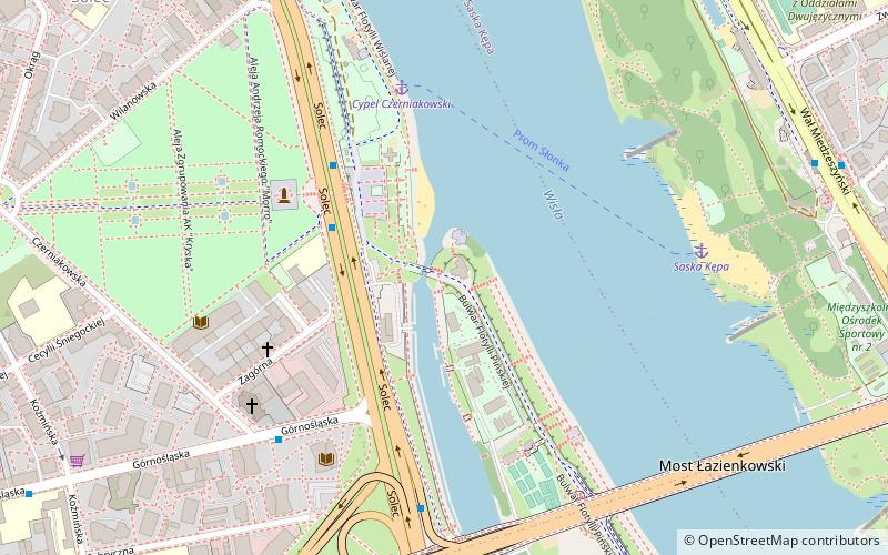
Cypel Czerniakowski, Warsaw
Facts and practical information
Cypel Czerniakowski is a place located in Warsaw (Masovian voivodeship) and belongs to the category of beach.
It is situated at an altitude of 259 feet, and its geographical coordinates are 52°13'40"N latitude and 21°2'39"E longitude.
Planning a visit to this place, one can easily and conveniently get there by public transportation. Cypel Czerniakowski is a short distance from the following public transport stations: Pomnik Sapera 01 (bus, 3 min walk), Most Poniatowskiego 03 (tram, 16 min walk), Warszawa Powiśle (train, 21 min walk), Centrum Nauki Kopernik (metro, 26 min walk).
Among other places and attractions worth visiting in the area are: Solec (neighbourhood, 6 min walk), Most Łazienkowski (bridge, 7 min walk), Torwar (sport, 10 min walk).
Śródmieścia (Solec)Warsaw
- Metro
- Bus
- Tram
- Train
 Metro
Metro
- Calculate routePomnik Sapera 01 3 min walk
- Calculate routeTorwar 04 5 min walk
- Calculate routeGórnośląska 01 5 min walk
- Calculate routeMost Poniatowskiego 03 16 min walk
- Calculate routeRondo Waszyngtona 06 20 min walk
- Calculate routeWarszawa Powiśle 21 min walk
- Calculate routeWarszawa Stadion 30 min walk
- Calculate routeCentrum Nauki Kopernik 26 min walk
- Calculate routeNowy Świat-Uniwersytet 34 min walk


Frequently Asked Questions (FAQ)
Which popular attractions are close to Cypel Czerniakowski?
How to get to Cypel Czerniakowski by public transport?
Bus
- Pomnik Sapera 01 • Lines: 185 (3 min walk)
- Torwar 04 • Lines: 185 (5 min walk)
Tram
- Most Poniatowskiego 03 • Lines: 22, 24, 25, 7, 9 (16 min walk)
- Rondo Waszyngtona 06 • Lines: 24, 9 (20 min walk)
Train
- Warszawa Powiśle (21 min walk)
- Warszawa Stadion (30 min walk)
Metro
- Centrum Nauki Kopernik • Lines: M2 (26 min walk)
- Nowy Świat-Uniwersytet • Lines: M2 (34 min walk)