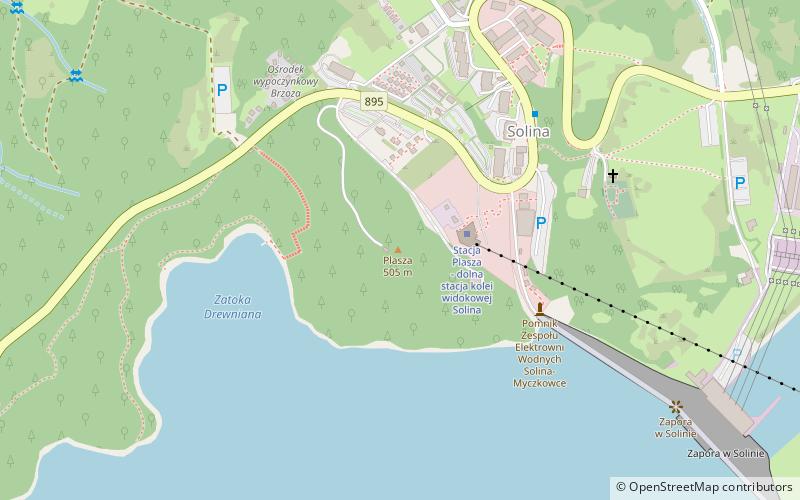
Trek Zone

Płasza, Solina

#2 among attractions in Solina

Nature, Natural attraction, Mountain
Płasza

Facts and practical information

Plasa - a peak in the Western Bieszczady Mountains rising on the left bank of the Solina Dam, which rests on its rocky shore. The southern slopes of Plasha descend steeply to Lake Solina formed before the dam, the eastern and northern slopes to Lake Myczkowskie behind the dam. The peak is mostly covered with forest, only on the north-eastern slopes there are buildings of the village Solina, a parking lot, rest houses and various objects serving tourists. An asphalt road to the dam in Solina and the provincial road no. 895 from Solina to Myczków run along the slopes. On the top the EmiTel company has built a 40 m high radio transmitter.

In some descriptions the name Płasza is used. On the Geoportal map the peak is described as Plasz and this is its correct name. It comes from the Romanian word ples meaning forestless area.

Coordinates: 49°23'53"N, 22°26'50"E
Address

Solina Poland

ContactAdd
Social media
Add

Solina plan & book

Unleash the traveler in you — discover the cheapest flight deals, find the perfect hotel or hostel nearby, and search for the best car rental prices. Travel at your own pace to discover new places and enjoy your journey.

Day trips

Płasza – popular in the area (distance from the attraction)

Nearby attractions include: Lesko, Lake Solina, Jawor Mountain, Zamek Kmitów.

  • lesko7.2 miNW
  • lake solina3.2 miS
  • jawor mountain2.3 miSE
  • zamek kmitow lesko7.4 miNW
  • kosciol parafialny nawiedzenia najswietszej maryi panny lesko7.4 miNW
  • park miniatur swiatyn4 miNW
  • kosciol pw matki bozej pieknej milosci2.6 miS
  • cerkiew pw sw bazylego5.8 miW
  • kosciol pw wniebowstapienia panskiego5.8 miSW
  • city hall lesko7.2 miNW
  • kosciol pw sw jozefa3.1 miN

Where to next? Visit subcarpathian Subcarpathian region page or discover the top tourist attractions in Poland.