Alexandra Canal

Gallery (3)
Map
Map
Gallery
Facts and practical information
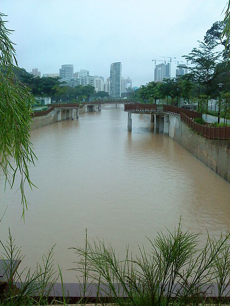
Alexandra Canal is a 1.2-kilometer long functional and concrete canal in Singapore which stretches from Tanglin Road to Delta Road and Prince Charles Crescent. The canal has been converted into a recreational destination as a part of the Active, Beautiful and Clean Water Programme undertaken by the Public Utilities Board of Singapore. ()
Coordinates: 1°18'0"N, 103°46'59"E
Location
Central
ContactAdd
Social media
Add
Day trips