Punggol Point Park, Singapore/East Coast
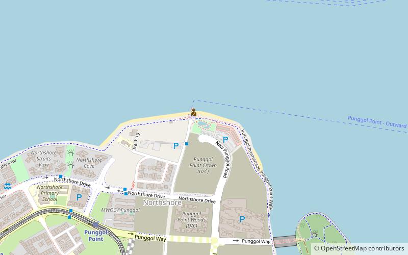
Map
Facts and practical information
Punggol Point Park, formerly known as Punggol Point, is located in Punggol, north-east of Singapore. ()
Elevation: 26 ft a.s.l.Coordinates: 1°25'16"N, 103°54'40"E
Address
Northeast Region (Punggol)Singapore/East Coast
ContactAdd
Social media
Add
Getting there by public transportation
Public transportation stops near this location
- Metro
- Bus
- Train
 Metro
Metro
- Calculate routePunggol Road End 2 min walk
- Calculate routeAfter Northshore Cresent 8 min walk
- Calculate routeBefore Northshore Cresent 8 min walk
- Calculate routeBlk 421C 11 min walk
- Calculate routePunggol Point 11 min walk
- Calculate routeSamudera 19 min walk
- Calculate routeSam Kee 23 min walk
- Calculate routeNibong 25 min walk
- Calculate routePunggol 32 min walk
Maps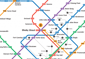 Metro
Metro
MetroDay trips


Frequently Asked Questions (FAQ)
How to get to Punggol Point Park by public transport?
The nearest stations to Punggol Point Park:
Bus
Train
Metro
Bus
- Punggol Road End • Lines: 84 (2 min walk)
- After Northshore Cresent • Lines: 84 (8 min walk)
Train
- Punggol Point (11 min walk)
- Samudera (19 min walk)
Metro
- Punggol • Lines: Nel (32 min walk)