Trek Zone

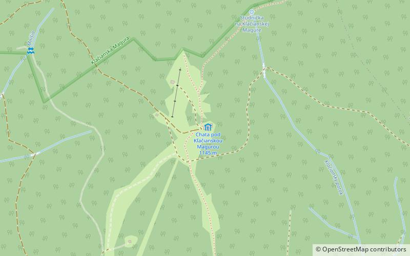
Chata pod Kľačianskou Magurou, Malá Fatra National Park

#11 among attractions in Malá Fatra National Park

Hiking, Alpine hut
Chata pod Kľačianskou Magurou

Facts and practical information

Chata pod Kľačianskou Magurou is a place located in Malá Fatra National Park (Žilinský region) and belongs to the category of hiking, alpine hut.

It is situated at an altitude of 3730 feet, and its geographical coordinates are 49°8'53"N latitude and 18°57'4"E longitude.

Among other places and attractions worth visiting in the area are: Chata pod Suchým (hiking, 54 min walk), Stratenec (natural attraction, 60 min walk), Vrútky (town, 67 min walk).

Coordinates: 49°8'53"N, 18°57'4"E
Address

Malá Fatra National Park Slovakia

Contact
Social media
Add

Malá Fatra National Park plan & book

Unleash the traveler in you — discover the cheapest flight deals, find the perfect hotel or hostel nearby, and search for the best car rental prices. Travel at your own pace to discover new places and enjoy your journey.

Day trips

Chata pod Kľačianskou Magurou – popular in the area (distance from the attraction)

Nearby attractions include: Vrátna dolina, Strečno Castle, Veľký Kriváň, Slovak National Library.

  • vratna dolina terchova6.6 miNE
  • strecno castle4.4 miNW
  • velky krivan terchova4.5 miNE
  • slovak national library martin5.5 miS
  • stratenec mala fatra national park2.4 miN
  • mala fatra mala fatra national park4.5 miNE
  • stary hrad mala fatra national park3.4 miNW
  • symbolicky cintorin vratna mala fatra national park5.9 miNE
  • vrutky2.6 miSW
  • martin ice stadium location map
    5.4 miS
  • chata vratna mala fatra national park5.9 miNE

Where to next? Visit zilinsky Žilinský region page or discover the top tourist attractions in Slovakia.