Fuencarral, Madrid
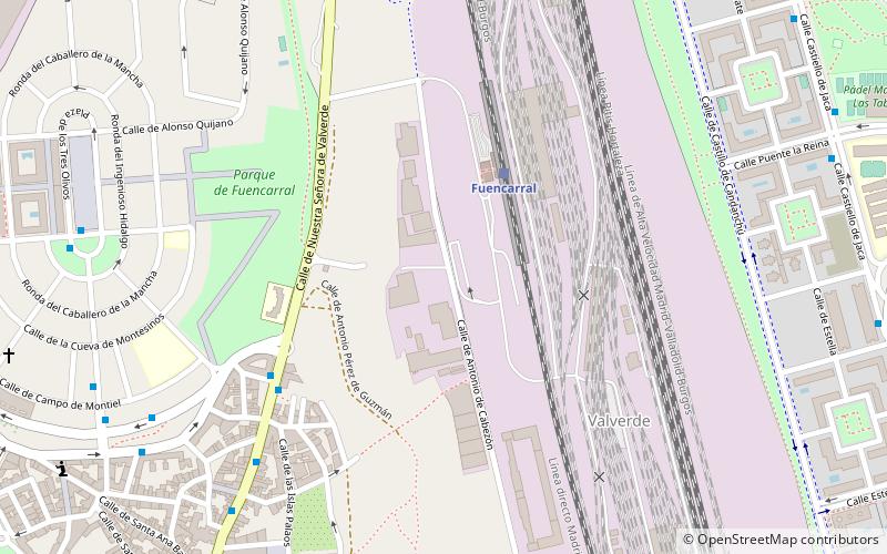
Map
Facts and practical information
Fuencarral is a neighborhood located in the northern part of Madrid, Spain. It includes the municipal area of the ancient town of Fuencarral, which was annexed to the city of Madrid by a decree of November 10, 1950. Administratively, Fuencarral belongs to the municipal district of Valverde in the district of Fuencarral-El Pardo. ()
Address
El Pardo (Valverde)Madrid
ContactAdd
Social media
Add
Getting there by public transportation
Public transportation stops near this location
- Metro
- Bus
- Light rail
- Train
 Metro
Metro
- Calculate routeEstación Cercanías de Fuencarral 3 min walk
- Calculate routeGta. Fuente de la Carra 6 min walk
- Calculate routeNtra. Sra. Valverde - Manuel Villarta 8 min walk
- Calculate routeAfueras a Valverde Nº 14 9 min walk
- Calculate routeFuencarral 4 min walk
- Calculate routeTres Olivos 16 min walk
- Calculate routeRamón y Cajal 26 min walk
- Calculate routeFuente de la Mora 38 min walk
- Calculate routeTres Olivos 15 min walk
- Calculate routeFuencarral 16 min walk
- Calculate routeMontecarmelo 19 min walk
- Calculate routeLas Tablas 24 min walk
- Calculate routePalas de Rey 27 min walk
- Calculate routeVirgen del Cortijo 38 min walk
- Calculate routeFuente de la Mora 39 min walk
Maps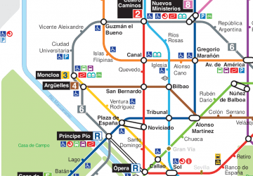 Metro
Metro
MetroDay trips


Frequently Asked Questions (FAQ)
How to get to Fuencarral by public transport?
The nearest stations to Fuencarral:
Bus
Train
Metro
Light rail
Bus
- Estación Cercanías de Fuencarral • Lines: T61 (3 min walk)
- Gta. Fuente de la Carra • Lines: 137, 66, N24, Se704 (6 min walk)
Train
- Fuencarral (4 min walk)
- Tres Olivos (16 min walk)
Metro
- Tres Olivos • Lines: L10 (15 min walk)
- Fuencarral • Lines: L10 (16 min walk)
Light rail
- Palas de Rey • Lines: Ml1 (27 min walk)
- Virgen del Cortijo • Lines: Ml1 (38 min walk)