Teurihorn
#1093 among destinations in Switzerland
Facts and practical information
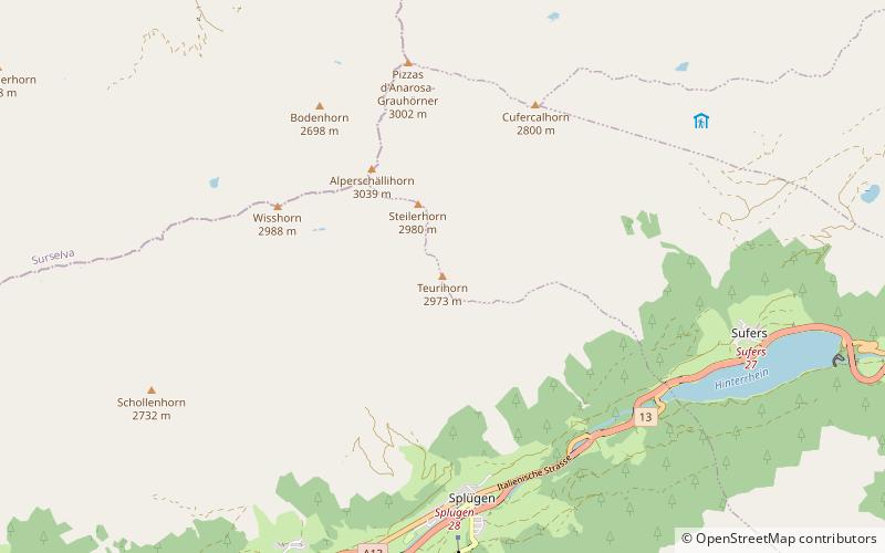
The Teurihorn is a mountain of the Swiss Lepontine Alps, overlooking Splügen in the canton of Graubünden. It is located between the valleys of the Stutzbach and the Steilerbach, south of the Alperschällihorn. ()
GraubündenSwitzerland
Teurihorn plan & book
Unleash the traveler in you — discover the cheapest flight deals, find the perfect hotel or hostel nearby, and search for the best car rental prices. Travel at your own pace to discover new places and enjoy your journey.
Teurihorn – popular in the area (distance from the attraction)
Nearby attractions include: Rofla Gorge, Sufnersee, Piz Beverin, Splügen Castle.
- 4.8 miENature, Natural attraction, Canyon
Rofla Gorge
124 min walk • The Rofla Gorge is an ancient and narrow section of the river Hinterrhein/Rein Posteriur between Sufers and Andeer in the canton of Graubünden. This narrow gorge was another obstacle on the approach to the two mountain passes Splügen Pass und San Bernardino Pass in addition to the Viamala gorge.
- 2.5 miENature, Natural attraction, Lake
Sufnersee
63 min walk • Sufnersee is a reservoir between Splügen and Sufers on the Hinterrhein river in the Grisons, Switzerland. The dam Sufers was built 1962. The reservoir has a volume of 17.5 million m³ and its surface area is 0.90 km².
- 5.6 miNNature, Natural attraction, Mountain
Piz Beverin
142 min walk • Piz Beverin is a mountain of the Lepontine Alps, overlooking Thusis in the canton of Graubünden. A trail leads to the summit.
- 1.6 miSEForts and castles
Splügen Castle
41 min walk • The ruins of the former Splügen Castle lie east of the village of Splügen in the Rheinwald forest in the Swiss canton of Graubünden. It is the only castle in the valley.
- 5.5 miNEForts and castles
Cagliatscha Castle
142 min walk • Cagliatscha Castle German: Burg Cagliatscha is a ruined castle in the municipality of Andeer in the Viamala Region of the canton of Graubünden in Switzerland.
- 5.6 miSENature, Natural attraction, Mountain
Piz Por, Montespluga
143 min walk • Piz Por is a mountain of the Oberhalbstein Alps, located west of Innerferrera in the canton of Graubünden. It is the culminating point of the group between the Splügen Pass and the Niemet Pass.
- 5.6 miNEValley
Schams, Andeer
144 min walk • The Schams is a section of the Hinterrhein valley in the Swiss canton of Graubünden.
- 4.1 miWNature, Natural attraction, Mountain
Bärenhorn
106 min walk • The Bärenhorn is a mountain of the Lepontine Alps, situated between Vals and Nufenen in Graubünden, on territory of both municipalities. The northeastern face lies on territory of Safien. A popular hike starts at Zervreila, passes three remote lakes and descends via Selva Alp to Vals. Vals is famous for its spa.
- 5.7 miSWNature, Natural attraction, Valley
Val Curciusa
145 min walk • The Val Curciusa is an alpine valley in Graubünden, Switzerland. In the region of the San Bernardino Pass, it provides a connection between the Rheinwald valley and the Misox valley.
- 3.9 miNNature, Natural attraction, Mountain
Bruschghorn
100 min walk • The Bruschghorn is a mountain of the Lepontine Alps, overlooking Thalkirch in the Swiss canton of Graubünden. With a height of 3,056 metres above sea level, the Bruschghorn is the culminating point of the range lying between the Safiental and the Domleschg valley.
- 0.9 miNWNature, Natural attraction, Mountain
Alperschällihorn
25 min walk • Alperschällihorn is a mountain of the Lepontine Alps, overlooking Splügen in the canton of Graubünden. The mountains is situated between the Safien valley and the Hinterrhein valley.