Refuge L'espace
#451 among destinations in Switzerland
Facts and practical information
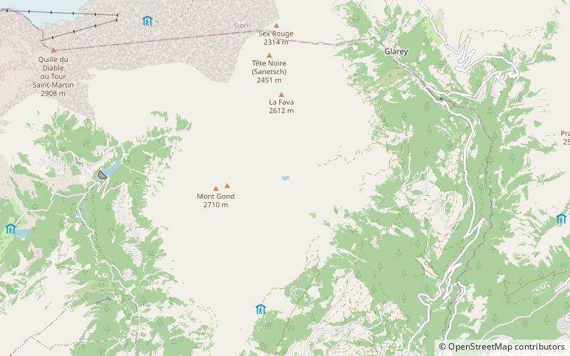
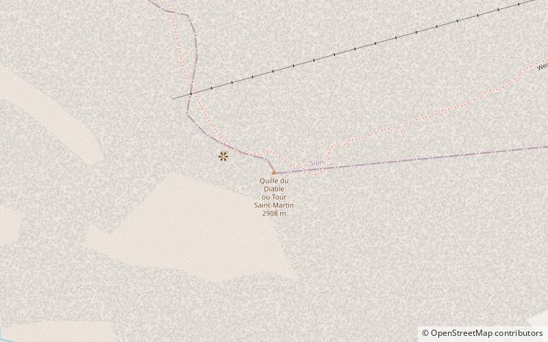
The Quille du Diable is a peak of the Diablerets massif, located on the border of the municipalities of Conthey and Savièse in the canton of Valais. It lies on the edge of the high Tsanfleuron Glacier plateau and overlooks the valley around of Derborence 1,500 metres lower. ()
Refuge L'espace plan & book
Unleash the traveler in you — discover the cheapest flight deals, find the perfect hotel or hostel nearby, and search for the best car rental prices. Travel at your own pace to discover new places and enjoy your journey.
Refuge L'espace – popular in the area (distance from the attraction)
Nearby attractions include: Lac de Derborence, Scex Rouge, Diablerets, Peak Walk.
- 2.1 miSScenic lake framed by mountains and trails
Lac de Derborence, Sion
55 min walk • Nestled in the heart of the Swiss Alps, Lac de Derborence is a hidden gem located near the city of Sion, Switzerland. This serene lake is a testament to the raw power of nature, having formed as a result of two massive rockslides from the Diablerets mountain range in...
- 1.5 miNWNature, Natural attraction, Mountain
Scex Rouge, Les Diablerets
39 min walk • The Scex Rouge is a mountain of the Alps, overlooking Les Diablerets in the canton of Vaud.
- 1.7 miWNature, Natural attraction, Mountain
Diablerets
43 min walk • The Diablerets are a huge ice-covered mountain massif of the Alps, culminating at the Sommet des Diablerets at 3,210 metres above sea level and straddling the border between the Swiss cantons of Vaud and Valais. The northeastern part of the massif stretches also into the canton of Bern.
- 1.6 miNWView point, Mountain, Bridge
Peak Walk, Les Diablerets
41 min walk • Peak Walk is a pedestrian suspension bridge linking two mountain peaks in the Swiss Alps. It is situated in the Diablerets massif of the Bernese Alps in the canton of Vaud, and connects the peak of Scex Rouge with another peak.
- 4.6 miNENature, Natural attraction, Lake
Lac de Sanetsch
118 min walk • Lac de Sanetsch is a reservoir below Sanetsch Pass in Valais, Switzerland. Its surface area is 29 ha. The Sanetsch dam was built in 1965. The gravity dam has a height of 42 metres.
- 1.4 miNNature, Natural attraction, Mountain
Oldenhorn
36 min walk • The Oldenhorn is a mountain in the western Bernese Alps in Switzerland. The summit is the tripoint between the cantons of Vaud, Berne and Valais. The Oldenhorn is the second highest peak of the massif of the Diablerets and canton of Vaud. It overlooks the Tsanfleuron Glacier on the south and the Col du Pillon on the north.
- 3 miSENature, Natural attraction, Lake
Etang de Trente Pas
78 min walk • Etang de Trente Pas is a small lake and bog below Mont Gond, above Conthey, in Valais, Switzerland. A literal translation of its name is "Pond of 30 steps". The unit of measure "pas" equaled about 60 centimeters.
- 2.5 miSENature, Natural attraction, Mountain
Mont Gond
64 min walk • Mont Gond is a mountain of the Bernese Alps, overlooking Derborence in Valais. It is located between the Diablerets and the Rhone valley.
- 2.3 miWNature, Natural attraction, Mountain
Tête Ronde
59 min walk • The Tête Ronde is a mountain of the Bernese Alps, located in the canton of Vaud, near the summit of the Diablerets massif of which it is a part. With an elevation of 3,037 metres above sea level, the Tête Ronde is the highest summit entirely within the canton of Vaud.
- 2.7 miENature, Natural attraction, Mountain
La Fava
69 min walk • La Fava is a mountain in the Bernese Alps in Valais, between the Diablerets and the Rhone valley.
- 4.9 miNENature, Natural attraction, Mountain
Arpelistock
126 min walk • The Arpelistock is a mountain of the Bernese Alps, located on the border between the Swiss cantons of Bern and Valais. It belongs to the massif of the Wildhorn and lies approximately halfway between the Sanetsch Pass and the summit of the Wildhorn.