Triebtenseewli
#1665 among destinations in Switzerland
Facts and practical information
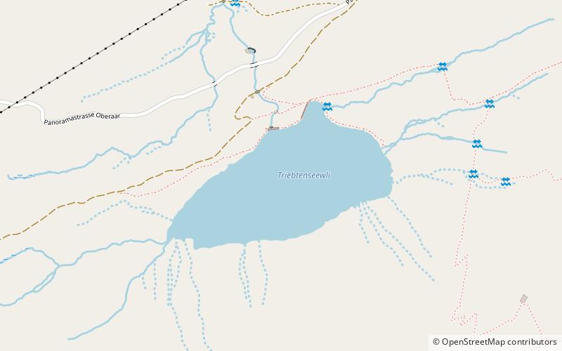
Triebtenseewli is a lake near Grimsel Pass in the Canton of Berne, Switzerland. Its surface area is 10 ha. ()
BernSwitzerland
Triebtenseewli – popular in the area (distance from the attraction)
Nearby attractions include: Gelmersee, Sidelhorn, Totesee, Grimselsee.
 Nature, Natural attraction, Lake
Gelmersee
117 min walk • Nestled in the heart of the Swiss Alps, Gelmersee is a breathtaking mountain lake that offers a serene escape amidst nature's pristine beauty. With its crystal-clear turquoise waters, the lake is a hidden gem located near the Grimsel Pass in the canton of Bern...
 Nature, Natural attraction, Mountain
Sidelhorn
19 min walk • The Sidelhorn is a mountain of the Bernese Alps, located west of the Grimsel Pass. It lies at the eastern end of the mountain chain between the Unteraar Glacier and the Rhone valley, named Aargrat.
 Nature, Natural attraction, Lake
Totesee
54 min walk • Totesee is a small natural lake at the Grimsel Pass in Switzerland. The lake lies immediately to the south of the natural watershed and cantonal boundary at the pass.
 Nature, Natural attraction, Lake
Grimselsee
25 min walk • The Grimselsee or Lake Grimsel is an artificial lake near the Grimsel Pass in the Canton of Berne, Switzerland. With a volume of 95 mio m³, it is larger than other hydroelectric reservoirs in the region: Oberaarsee, Räterichsbodensee and Gelmersee.
 Nature, Natural attraction, Lake
Räterichsbodensee
69 min walk • Räterichsbodensee is a lake in Guttannen, Oberhasli, Switzerland. The reservoir has a volume of 25 mio m³, a surface area is 0.67 km² and is operated by Kraftwerke Oberhasli. It is connected to the river Aare.
 Nature, Natural attraction, Lake
Oberaarsee
52 min walk • Oberaarsee is a hydroelectric reservoir in the Grimsel area, part of the municipality of Guttannen, Switzerland. Its surface area is 1.47 km². The Oberaar dam was completed in 1953, and is operated by Kraftwerke Oberhasli. It is drained by the Oberaarbach, which flows into the Grimselsee. The Oberaar glacier is located west of the lake.
 Alpine hut, Hiking
Lauteraar Hut
97 min walk • The Lauteraar Hut is a mountain hut of the Swiss Alpine Club, located south-west of Handegg in the canton of Bern. The hut lies at a height of 2,392 metres above sea level, above the Unteraar Glacier, at the foot of the Hienderstock in the Bernese Alps.
 Nature, Natural attraction, Mountain pass
Hotel Grimsel Passhöhe
52 min walk • The Grimsel Pass is a mountain pass in Switzerland, crossing the Bernese Alps at an elevation of 2,164 metres. The pass connects the Haslital, the upper valley of the river Aare, with the upper valley of the Rhône.
 Nature, Natural attraction, Natural feature
Unteraargletscher
110 min walk • The Unteraargletscher, literally "Lower Aare-Glacier", is the larger of the two sources of the Aare river in the Bernese Alps. It emerges from the association of the Finsteraargletscher and the Lauteraargletscher and flows for about 6 km to the east down to the Grimselsee near the Grimsel Pass.
 Mountain
Brünberg, Swiss Alps Jungfrau-Aletsch
47 min walk • The Brünberg is a mountain of the Bernese Alps, overlooking the Grimselsee in the canton of Bern. It is composed of several summits, of which the highest has an elevation of 2,982 metres above sea level.
 Nature, Natural attraction, Lake
Trübtensee
1 min walk • Trübtensee or Triebtenseewli is a lake in the municipality of Guttannen, Bernese Oberland, Switzerland. The reservoir's surface area is 0.1 km². Its dam was completed in the 1950s and holds a volume of 1.1 mio m³.


