Kirche Enge, Zurich


Facts and practical information
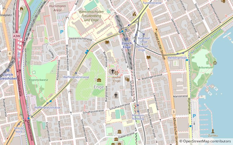
Kirche Enge (address: Bederstrasse 25) is a place located in Zurich (Zürich canton) and belongs to the category of church.
It is situated at an altitude of 1424 feet, and its geographical coordinates are 47°21'45"N latitude and 8°31'48"E longitude.
Planning a visit to this place, one can easily and conveniently get there by public transportation. Kirche Enge is a short distance from the following public transport stations: Bahnhof Enge/Bederstrasse (bus, 3 min walk), Zürich Enge (train, 4 min walk), Waffenplatzstrasse (tram, 4 min walk), Waffenplatz-/Bederstrasse (trolleybus, 5 min walk), Zürich Bürkliplatz (ferry, 16 min walk), Bahnhof Stadelhofen (light rail, 23 min walk).
Among other places and attractions worth visiting in the area are: Enge (neighbourhood, 1 min walk), FIFA World Football Museum (museum, 3 min walk), Tessinerplatz (square, 3 min walk).
Kirche Enge – popular in the area (distance from the attraction)
Nearby attractions include: Confiserie Sprüngli, Strandbad Mythenquai, Sihlcity, Voliere Zürich.
Frequently Asked Questions (FAQ)
When is Kirche Enge open?
- Monday 9 am - 9 pm
- Tuesday 9 am - 9 pm
- Wednesday 9 am - 9 pm
- Thursday 9 am - 9 pm
- Friday 9 am - 9 pm
- Saturday 12 pm - 9 pm
- Sunday 12 pm - 9 pm
Which popular attractions are close to Kirche Enge?
How to get to Kirche Enge by public transport?
Bus
- Bahnhof Enge/Bederstrasse • Lines: 200, 210, 444, 445 (3 min walk)
- Kantonsschule Enge • Lines: 66 (4 min walk)
Train
- Zürich Enge (4 min walk)
- Zürich Giesshübel (10 min walk)
Tram
- Waffenplatzstrasse • Lines: 10, 13, 17, 5 (4 min walk)
- Bahnhof Enge • Lines: 10, 5, 6, 7 (4 min walk)
Trolleybus
- Waffenplatz-/Bederstrasse • Lines: 72 (5 min walk)
- Hügelstrasse • Lines: 72 (9 min walk)
Ferry
- Zürich Bürkliplatz • Lines: 3730, 3731 (16 min walk)
- Zürich Bellevue (19 min walk)
Light rail
- Bahnhof Stadelhofen • Lines: S18 (23 min walk)
- Kreuzplatz • Lines: 11, 8, S18 (29 min walk)


