Oltschiburg
#1306 among destinations in Switzerland
Facts and practical information
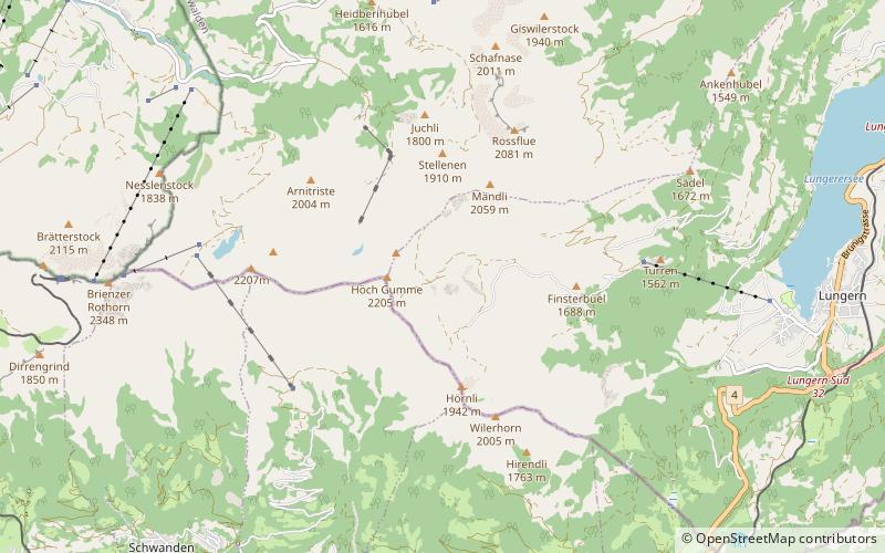
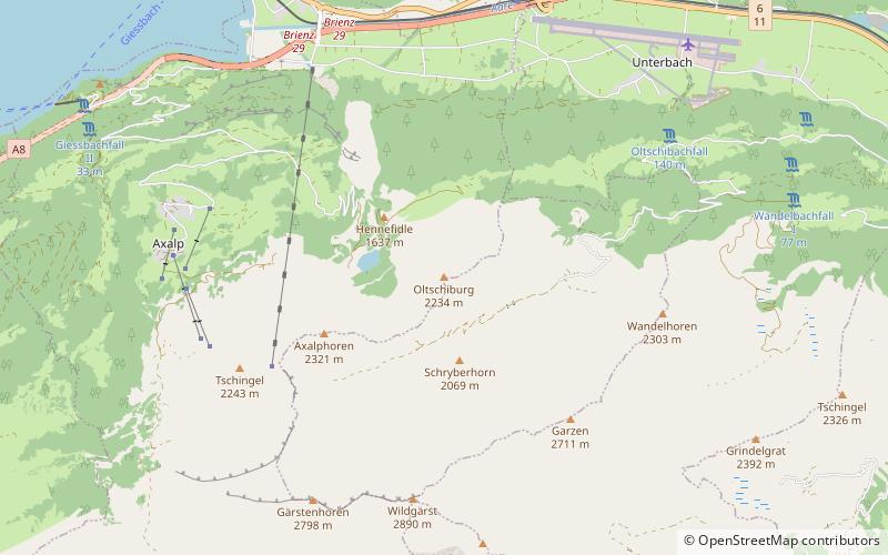
The Oltschiburg is a mountain of the Bernese Alps, overlooking Lake Brienz in the Bernese Oberland. It lies on the chain that lies north of the Grosse Scheidegg and that culminates at the Schwarzhorn. The closest locality is Axalp. ()
BernSwitzerland
Oltschiburg – popular in the area (distance from the attraction)
Nearby attractions include: Reichenbach Falls, Bachalpsee, Ballenberg, First.
4.9 miELarge waterfall with cable car ridesReichenbach Falls, Meiringen
126 min walk • Nestled in the picturesque landscape of the Bernese Alps, the Reichenbach Falls is a natural wonder that draws visitors to the quaint town of Meiringen, Switzerland. This breathtaking waterfall, known for its sheer power and beauty, cascades down the rocks in a series...
4.2 miSWScenic mountain lake with hiking trailsBachalpsee, Grindelwald
108 min walk • Nestled in the heart of the Swiss Alps, the Bachalpsee is a serene alpine lake that epitomizes the idyllic beauty of Grindelwald, Switzerland. This tranquil body of water is situated at an elevation of 2,265 meters above sea level and offers a peaceful retreat for...
2.3 miNVillage-style living history museumBallenberg, Brienz
58 min walk • Ballenberg is an open-air museum in Switzerland that displays traditional buildings and architecture from all over the country. Located near Brienz in the municipality of Hofstetten bei Brienz, Canton of Bern, Ballenberg has over 100 original buildings that have been transported from their original sites.
4.1 miSSummit with cable cars and dramatic viewsFirst, Grindelwald
104 min walk • First is a mountain location and minor summit on the slopes of the Schwarzhorn in the Bernese Oberland. It is mostly known as a cable car station above Grindelwald and as a popular hiking area with the Bachalpsee in proximity.
4.7 miSWNatural attraction, Mountain, ParkFaulhorn, Grindelwald
121 min walk • The Faulhorn is a mountain of the Bernese Alps, located between Lake Brienz and Grindelwald in the Bernese Oberland. The summit is 2,681 metres high and can be reached by several trails.
0.6 miWNature, Natural attraction, LakeHinterburgsee
15 min walk • Hinterburgsee is a lake in the Canton of Berne, Switzerland. Its surface area is 5 ha.
2.1 miSMountain with hiking and panoramic viewsSchwarzhorn
54 min walk • The Schwarzhorn is a mountain of the Bernese Alps, located between Brienz and Grindelwald in the Bernese Oberland. With a height of 2,928 metres above sea level, it is the highest summit of the group north of the Grosse Scheidegg Pass.
5 miNNature, Natural attraction, MountainHöch Gumme
127 min walk • The Höch Gumme is a mountain of the Emmental Alps in Switzerland. It lies to the east of the Brienzer Rothorn and Arnihaaggen, and the west of the Wilerhorn and Brünig Pass. The Schönbüel cable car station is on its eastern flank.
5 miNNature, Natural attraction, MountainSchönbüel
128 min walk • Schönbüel is a prominence east of the Höch Gumme in the Emmental Alps. It can be accessed by cable car from Lungern.
4.8 miSWNature, Natural attraction, MountainReeti
122 min walk • The Reeti is a mountain of the Bernese Alps, overlooking Grindelwald in the Bernese Oberland. From the Bachalpsee, a trail leads to the summit.
3 miENature, Natural attraction, MountainTschingel
78 min walk • The Tschingel is a mountain of the Bernese Alps, overlooking Meiringen in the Bernese Oberland. It constitutes the eastern end of the Grindelgrat, a ridge descending from the Garzen summit. The summit is on the border between Meiringen and Schattenhalb municipalities.