Rüdigenspitze
#1622 among destinations in Switzerland

Facts and practical information
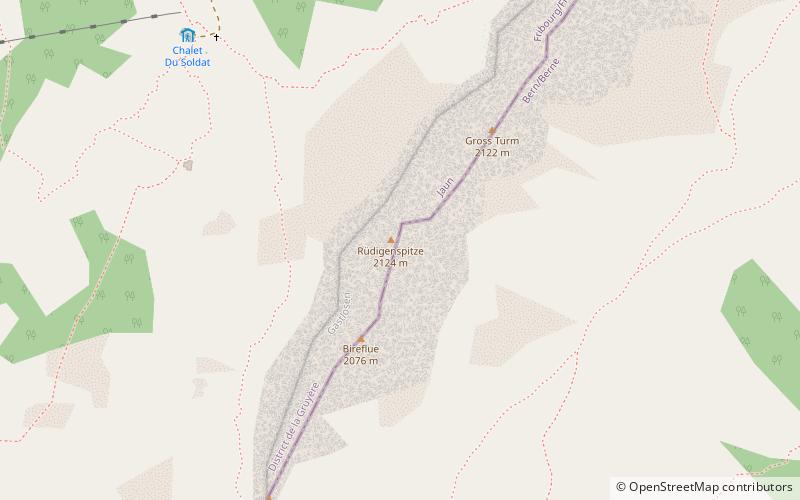
The Rüdigenspitze is a mountain of the Gastlosen, located on the border between the Swiss cantons of Fribourg and Bern. It lies south of Jaun. ()
FribourgSwitzerland
Rüdigenspitze plan & book
Unleash the traveler in you — discover the cheapest flight deals, find the perfect hotel or hostel nearby, and search for the best car rental prices. Travel at your own pace to discover new places and enjoy your journey.
Rüdigenspitze – popular in the area (distance from the attraction)
Nearby attractions include: Bäderhorn, Dent de Brenleire, Dent de Ruth, Dent de Savigny.
 Nature, Natural attraction, Mountain
Bäderhorn
101 min walk • The Bäderhorn is a mountain of the Bernese Alps, located north of the Jaun Pass in the canton of Bern. It lies on the range between the valleys of Jaun and Simmental.
 Nature, Natural attraction, Mountain
Dent de Brenleire
120 min walk • The Dent de Brenleire is a mountain of the Fribourg Alps, located south of Charmey in the Swiss canton of Fribourg. It has an elevation of 2,353 metres above sea level and is amongst the highest summits in the canton of Fribourg, after the Vanil Noir, the Vanil de l'Ecri and the Pointe de Paray.
 Nature, Natural attraction, Mountain
Dent de Ruth
52 min walk • The Dent de Ruth is a mountain in the Bernese Alps in Switzerland. The summit is the tripoint between the cantons of Vaud, Berne and Fribourg.
 Nature, Natural attraction, Mountain
Dent de Savigny
66 min walk • The Dent de Savigny is a mountain of the Bernese Alps, located on the border between the Swiss cantons of Vaud and Fribourg. With an elevation of 2,252 metres above sea level, it one of the highest mountains in the canton of Fribourg.
 Nature, Natural attraction, Mountain
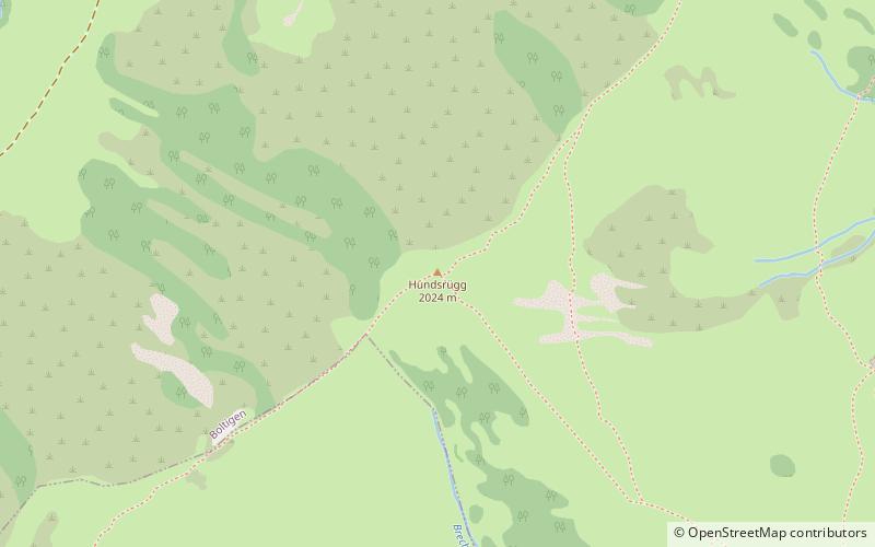
Hundsrügg
54 min walk • The Hundsrügg is a mountain of the Bernese Alps, located west of Zweisimmen in the Bernese Oberland. It is the highest point of the chain south of the Jaun Pass and east of the Gastlosen.
 Nature, Natural attraction, Mountain
Schopfenspitz
89 min walk • The Schopfenspitz is a mountain of the Bernese Alps, overlooking Jaun in the canton of Fribourg. It is the culminating point of the group lying between Charmey and the Euschelspass.
 Nature, Natural attraction, Mountain
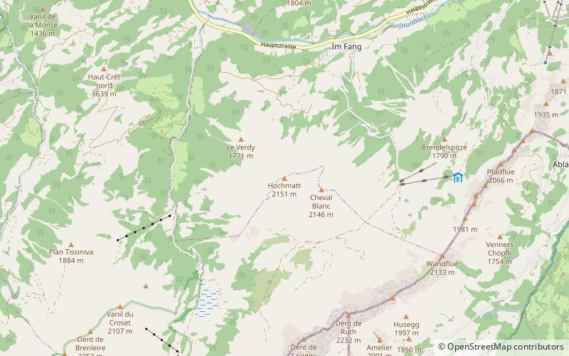
Hochmatt
57 min walk • The Hochmatt is a mountain of the Bernese Alps, located south of Jaun in the canton of Fribourg. It lies west of the Gastlosen chain.
 Nature, Natural attraction, Mountain
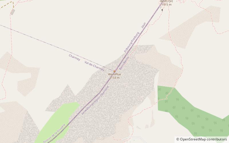
Wandflue
21 min walk • The Wandflue is a mountain of the Bernese Alps, located on the border between the Swiss cantons of Fribourg and Bern. It lies south of Jaun in the Gastlosen chain.
 Nature, Natural attraction, Mountain
Vanil d'Arpille
85 min walk • The Vanil d'Arpille is a mountain of the Swiss Prealps, located north of Im Fang in the canton of Fribourg.
 Natural attraction, Valley
Simmental, Zweisimmen
119 min walk • The Simmental is an alpine valley in the Bernese Oberland of Switzerland. It expands from Lenk to Boltigen, in a more or less south-north direction, and from there to the valley exit at Wimmis near Spiez it takes a west-east orientation. It comprises the municipalities of Lenk, St.
 Nature, Natural attraction, Mountain pass
Jaun Pass
91 min walk • Jaun Pass is a high mountain pass in the Swiss Alps linking Charmey and Jaun in the canton of Fribourg with Reidenbach in the canton of Bern. The pass itself is located within the canton of Berne. The pass road was completed in 1878.


