Färichhorn
#1551 among destinations in Switzerland

Facts and practical information
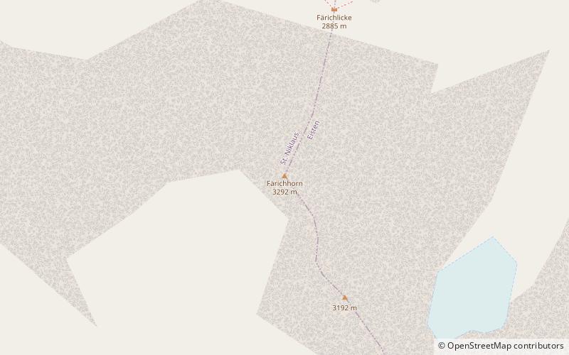
The Färichhorn is a mountain of the Pennine Alps, located between the Mattertal and the Saastal in the canton of Valais. It lies north of the Balfrin, at a height of 3,292 metres above sea level. ()
ValaisSwitzerland
Färichhorn plan & book
Unleash the traveler in you — discover the cheapest flight deals, find the perfect hotel or hostel nearby, and search for the best car rental prices. Travel at your own pace to discover new places and enjoy your journey.
Färichhorn – popular in the area (distance from the attraction)
Nearby attractions include: Dom Mountain, Nadelhorn, Dom Hut, Lenzspitze.
 Pennine peak first climbed in 1858
Dom Mountain
109 min walk • Dom Mountain, rising majestically in the Swiss Alps, is a breathtaking natural wonder that commands respect and admiration. At 4,545 meters, it is the highest mountain situated entirely within Switzerland and the third highest in the Alps.
 Nature, Natural attraction, Mountain
Nadelhorn
83 min walk • The Nadelhorn is a mountain in the Pennine Alps in Switzerland. It is the highest point on the Nadelgrat, a high-level ridge running roughly north–south above the resort of Saas-Fee to the east, and the Mattertal to the west.
 Alpine hut, Hiking
Dom Hut
106 min walk • The Dom Hut is a mountain hut of the Swiss Alpine Club, located above Randa in the canton of Valais. The hut lies on the western sloped of the Dom, at a height of 2,940 m above sea level, near the bottom of the Festigletscher glacier in the Pennine Alps.
 Nature, Natural attraction, Mountain
Lenzspitze
91 min walk • The Lenzspitze is a 4,294-metre mountain in the Pennine Alps in Switzerland. It is the southernmost peak on the Nadelgrat, a high-level ridge running roughly north–south, north of Dom in the Mischabel range, above the resort of Saas Fee to the east, and the Mattertal to the west.
 Alpine hut, Hiking
Mischabel Hut
89 min walk • The Mischabel Hut is a mountain hut of the Academic Alpine Club of Zurich, located west of Saas Fee in the canton of Valais. It lies at a height of 3,340 metres above sea level near the Hohbalmgletscher glacier, on the eastern flanks of the Dom and the Lenzspitze in the Mischabel group.
 Nature, Natural attraction, Mountain
Balfrin
45 min walk • The Balfrin is a mountain of the Swiss Pennine Alps, located north of the Dom in the canton of Valais. It belongs to the Mischabel massif, which lies between the Mattertal and the Saastal.
 Nature, Natural attraction, Mountain
Ulrichshorn
70 min walk • The Ulrichshorn is a mountain of the Swiss Pennine Alps, overlooking Saas-Fee in the canton of Valais. It is located north of the Nadelhorn, in the Mischabel range, which lies between the Mattertal and the Saastal.
 Nature, Natural attraction, Mountain
Dürrenhorn
65 min walk • The Dürrenhorn is a summit in the Pennine Alps in Switzerland. It lies towards the northern end of the Nadelgrat, a high-level ridge running roughly north–south above the resort of Saas-Fee to the east, and the Mattertal to the west.
 Nature, Natural attraction, Mountain
Hohberghorn
76 min walk • The Hohberghorn is a mountain in the Pennine Alps in Switzerland. It lies towards the northern end of the Nadelgrat, a high-level ridge running roughly north–south, north of the Dom, above the resort of Saas-Fee to the east, and the Mattertal to the west.
 Nature, Natural attraction, Mountain
Seetalhorn
56 min walk • The Seetalhorn is a mountain of the Swiss Pennine Alps, overlooking Grächen in the canton of Valais. With an elevation of 3,037 m, it is the highest point of the ski area of Grächen.
 Nature, Natural attraction, Mountain
Bigerhorn
24 min walk • The Bigerhorn is a mountain of the Swiss Pennine Alps, located south of Grächen in the canton of Valais. It lies in the Mischabel range, north of the Ried Glacier. From the Bordier Hut, a trail leads to the summit of the Bigerhorn.


