Cima di Rosso
#1327 among destinations in Switzerland
![Cima di Rosso location map](https://tzmedia.b-cdn.net/media/images/static-maps/ch/46_3064_9_71852.jpg)
Facts and practical information
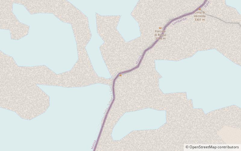
The Cima di Rosso is a mountain in the Bregaglia Range of the Alps, located on the border between Italy and Switzerland. It lies between the valleys of Bregaglia and Malenco. On the western side of the mountain is the Forno Glacier. ()
GraubündenSwitzerland
Cima di Rosso plan & book
Unleash the traveler in you — discover the cheapest flight deals, find the perfect hotel or hostel nearby, and search for the best car rental prices. Travel at your own pace to discover new places and enjoy your journey.
Cima di Rosso – popular in the area (distance from the attraction)
Nearby attractions include: Lägh da Cavloc, Monte del Forno, Albigna lake, Piz Cengalo.
5.1 miNNature, Natural attraction, LakeLägh da Cavloc
131 min walk • Nestled in the heart of the Swiss Alps, Lägh da Cavloc is a serene mountain lake that offers a tranquil escape from the hustle and bustle of everyday life. This alpine gem, located in the canton of Graubünden, is a pristine example of nature's beauty, with...
2.2 miNNature, Natural attraction, MountainMonte del Forno
57 min walk • Monte del Forno is a mountain in the Bregaglia Range, located on the border between Italy and Switzerland. On its western side it overlooks the Forno Glacier.
3.7 miNWNature, Natural attraction, LakeAlbigna lake
95 min walk • Albigna Lake is a reservoir in the canton of Graubünden, Switzerland. It is located in the municipality of Vicosoprano at an elevation of 2,163 metres on the southwest side of the Bregaglia valley, northeast of Pizzo Cacciabella.
5.6 miWNature, Natural attraction, MountainPiz Cengalo
144 min walk • Piz Cengalo is a mountain in the Bregaglia range of the Alps on the border between the Swiss canton of Graubünden and Italy. The first ascent of the mountain was by D. W. Freshfield and C. Comyns Tucker with guide F. Dévouassoud on 25 July 1866. The name 'Cengalo' derives from Tschingel, meaning girdle. On 28 December 2011 c.
4.5 miWNature, Natural attraction, MountainSciora Dadent
115 min walk • The Sciora Dadent is a mountain in the Bregaglia Range of the Alps, located south of Vicosoprano in the canton of Graubünden. It is the highest and southernmost summit of the Sciora group.
5.2 miNNature, Natural attraction, MountainPiz da la Margna
134 min walk • Piz da la Margna is a mountain in the Bernina Range of the Alps, overlooking Lake Sils in the Swiss canton of Graubünden. It lies to the south-east of the Maloja Pass at the south-western end of the Engadin valley.
4.4 miWNature, Natural attraction, MountainPiz Cacciabella
113 min walk • Piz Cacciabella is a mountain in the Bregaglia Range of the Alps, overlooking Vicosoprano in the canton of Graubünden. It is the northernmost summit of the range between the valleys of Bondasca and Albigna.
6.7 miNENature, Natural attraction, MountainIl Chapütschin
172 min walk • Il Chapütschin is a mountain in the Bernina Range of the Alps, located between the Val Fex and the Val Roseg in the canton of Graubünden. On its eastern side it overlooks the Roseg Glacier.
4.4 miWNature, Natural attraction, MountainAgo di Sciora
113 min walk • Ago di Sciora is a mountain in the Bregaglia Range of the Alps, located south of Vicosoprano in the canton of Graubünden. It forms a sharp needle in the middle of the Sciora group.
2 miWNature, Natural attraction, MountainCima di Castello
51 min walk • Cima di Castello is a mountain of the Bregaglia Range, located on the border between Italy and Switzerland. With a height of 3,379 metres above sea level, it is the second highest mountain in the Bregaglia Range.
5.9 miNENature, Natural attraction, MountainPiz Tremoggia
151 min walk • Piz Tremoggia is a mountain in the Bernina Range of the Alps, located on the border between Italy and Switzerland. It lies between the Val Fex and the Val Malenco.