Platthorn
#617 among destinations in Switzerland
![Platthorn location map](https://tzmedia.b-cdn.net/media/images/static-maps/ch/46_0537_7_7364.jpg)
Facts and practical information
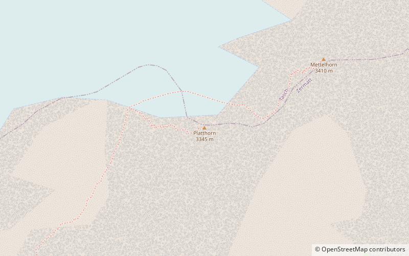
The Platthorn is a mountain of the Swiss Pennine Alps, located south of Grächen in the canton of Valais. It lies north of the Färichhorn and the Balfrin, on the range between the Mattertal and the Saastal. ()
ValaisSwitzerland
Platthorn plan & book
Unleash the traveler in you — discover the cheapest flight deals, find the perfect hotel or hostel nearby, and search for the best car rental prices. Travel at your own pace to discover new places and enjoy your journey.
Platthorn – popular in the area (distance from the attraction)
Nearby attractions include: Grand Mountet Hut, Weisshorn, Matterhorn Museum, Unterrothorn.
4 miWAlpine hut, HikingGrand Mountet Hut
102 min walk • Nestled amidst the Swiss Alps, the Grand Mountet Hut is a beacon for mountaineers and hikers seeking the thrill of high-altitude adventure. Perched at an elevation of 2,886 meters, this alpine hut is a popular base for ambitious climbers aiming to conquer the...
3.4 miNNature, Natural attraction, MountainWeisshorn
88 min walk • Rising majestically above the Swiss canton of Valais, the Weisshorn stands as a testament to the breathtaking beauty of the Alps. This imposing mountain, part of the Pennine Alps, reaches an elevation of 4,506 meters, making it one of the highest peaks in Switzerland.
2.4 miSMuseum, History museumMatterhorn Museum, Zermatt
61 min walk • The Matterhorn Museum in Zermatt is a cultural-natural museum whose main theme is the Matterhorn.
3.7 miSEGrand mountain with a cable carUnterrothorn, Zermatt
94 min walk • The Unterrothon is a mountain of the Swiss Pennine Alps, overlooking Zermatt in the canton of Valais. It is located west of the Oberrothorn, on the range north of the Findel Glacier. The summit can be reached by cable car via Sunnegga and Blauherd. The Rothorn paradise is one of the main ski areas located around Zermatt.
2.9 miS46°0'45"N • 7°44'26"EForest Fun Park Zermatt, Zermatt
73 min walk • Climbing, Adrenaline and extreme tours, Adventure park
~1460 ftNENatural attraction, Mountain, ParkMettelhorn, Zermatt
8 min walk • The Mettelhorn is a mountain of the Swiss Pennine Alps, located near Zermatt in the canton of Valais. The Mettelhorn provides excellent acclimatization opportunities, especially if one climbs its sister peaks Platthorn and Wisshorn on the same day.
4.1 miSENatural attraction, Lake, Body of waterGrünsee, Zermatt
104 min walk • The Grünsee is a small lake near Zermatt, Switzerland, which is fed by the Findel Glacier. It is quite remote and is only accessible by foot, a small hub of the many footpaths in the area. There is a small hamlet nearby of the same name.
3.5 miWNature, Natural attraction, MountainOber Gabelhorn
89 min walk • The Ober Gabelhorn is a mountain in the Pennine Alps in Switzerland, located between Zermatt and Zinal.
2.3 miWNature, Natural attraction, MountainZinalrothorn
60 min walk • The Zinalrothorn is a mountain in the Pennine Alps in Switzerland. Its name comes from the village of Zinal lying on the north side and from the German word Rothorn which means Red Peak.
2.3 miNAlpine hut, HikingWeisshorn Hut
58 min walk • The Weisshorn Hut is a mountain hut of the Swiss Alpine Club, located above Randa in the canton of Valais. It is located on the southern slopes of the Weisshorn, at a height of 2,932 metres above sea level, near the bottom of the Schali Glacier.
2.8 miWNature, Natural attraction, MountainTrifthorn
72 min walk • The Trifthorn is a mountain of the Swiss Pennine Alps, located west of Zermatt in the canton of Valais. It is located in the middle of the ridge connecting the Ober Gabelhorn from the Zinalrothorn.