Altmann Mountain
#402 among destinations in Switzerland
Facts and practical information
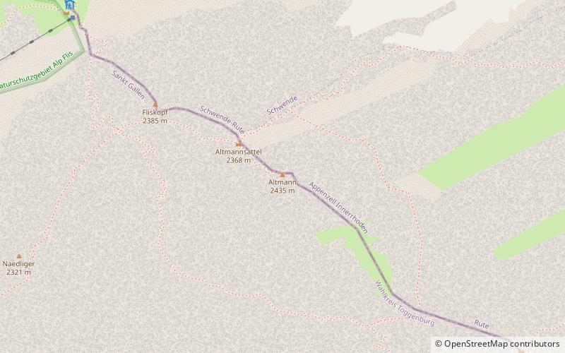
The Altmann is a mountain in the Appenzell Alps, located on the border between the cantons of Appenzell Innerrhoden and St. Gallen. It is situated in the massif of the Alpstein north of Wildhaus, a few kilometres from the Säntis. ()
Sankt GallenSwitzerland
Altmann Mountain – popular in the area (distance from the attraction)
Nearby attractions include: Seealpsee, Säntis, Wildkirchli, Säntis.
2.4 miNENature, Natural attraction, LakeSeealpsee
62 min walk • Nestled in the heart of the Swiss Alps, Seealpsee is a serene mountain lake that epitomizes the idyllic beauty of Switzerland's landscape. Located in the canton of Appenzell Innerrhoden, this tranquil body of water sits at an elevation of 1,143 meters, offering...
2.2 miNWNature, Natural attraction, MountainSäntis
56 min walk • Rising majestically above the Alpstein massif, Säntis stands as a prominent landmark in the Eastern Alps of Switzerland. At an impressive height of 2,502 meters, it is the highest mountain in the Alpstein range and offers breathtaking panoramic views that sweep across...
3.4 miNEArchaeological siteWildkirchli
87 min walk • Nestled within the rugged Alpstein massif of Switzerland lies the Wildkirchli, an archaeological site that transports visitors back to the early chapters of human history. This prehistoric site is composed of three caves, which served as a sanctuary for hermits and a...
1.5 miNWTowerSäntis
38 min walk • The Säntis transmitter is a 123.5 m high transmitting station on the summit of the 2,502 m high Säntis mountain in Switzerland. It is operated by Swisscom. The original microwave station was built in 1955, but because Säntis is directly exposed to north-western weather the unprotected microwave radio antennae regularly iced up in winter.
2.3 miENature, Natural attraction, LakeFälensee
60 min walk • Fälensee is a lake in the Alpstein range of the canton of Appenzell Innerrhoden, Switzerland. At an elevation of 1446 m, the surface area is 0.12 km². It is located in a narrow valley between Hundsteingrat and Roslen-Saxer First.
2.2 miNNature, Natural attraction, MountainAltenalp Türm
56 min walk • The Altenalp Türm is a peak of the Alpstein massif, located in the canton of Appenzell Innerrhoden, on the ridge between Ebenalp and the Säntis. It is the northernmost peak rising above 2,000 metres in Switzerland.
3.7 miENature, Natural attraction, MountainHüser
96 min walk • The Furgglenfirst is a multi-summited mountain of the Appenzell Alps located on the border between the Swiss cantons of Appenzell Innerrhoden and St. Gallen. The main summit, named Hintere Hüser, has a height of 1,951 metres above sea level.
1.1 miSWNature, Natural attraction, MountainWildhuser Schafberg
30 min walk • The Wildhuser Schafberg is a mountain of the Appenzell Alps, overlooking Wildhaus in the canton of St. Gallen. It is situated in the massif of the Alpstein, on the range west of the Altmann.
1.7 miNENature, Natural attraction, MountainHundstein
43 min walk • The Hundstein is a mountain in the Alpstein massif of the Appenzell Alps, located south of Schwende in the canton of Appenzell Innerrhoden. It lies on the range east of the Altmann, between the valleys of the Seealpsee and the Fälensee.
2.1 miNENature, Natural attraction, MountainMarwees
55 min walk • The Marwees is a mountain in the Alpstein massif of the Appenzell Alps, located south of Schwende in the canton of Appenzell Innerrhoden. It lies on the range east of the Altmann, between the valleys of the Seealpsee and the Sämtisersee.
3.4 miEForts and castlesHohensax Castle
88 min walk • Hohensax is a ruined castle in the Sennwald municipality in the Swiss canton St. Gallen. The castle was built around 1200 by the barons of Sax, and was destroyed in 1446.