Burg Blatten, Oberriet
#2 among attractions in Oberriet
![Burg Blatten location map](https://tzmedia.b-cdn.net/media/images/static-maps/ch/47_308_9_56491.jpg)
Facts and practical information
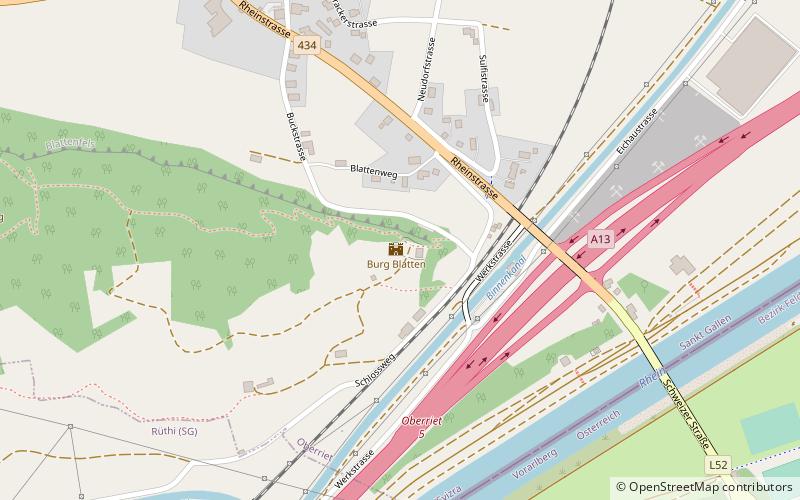
Blatten Castle is a ruined castle in the municipality of Oberriet, in the canton of St. Gallen in Switzerland. The square keep stands not far from the Rhine on a rock south of the municipality of Oberriet.
Oberriet Switzerland
Oberriet plan & book
Unleash the traveler in you — discover the cheapest flight deals, find the perfect hotel or hostel nearby, and search for the best car rental prices. Travel at your own pace to discover new places and enjoy your journey.
Burg Blatten – popular in the area (distance from the attraction)
Nearby attractions include: Sämtisersee, Gäbris, Wichenstein Castle, Kamor.
5.6 miSWNature, Natural attraction, LakeSämtisersee
144 min walk • Nestled in the picturesque Alpstein massif of northeastern Switzerland, Sämtisersee is a serene mountain lake that offers an idyllic escape into nature. This tranquil body of water is situated at an elevation of approximately 1,205 meters above sea level, making it a...
6.8 miNWNature, Natural attraction, MountainGäbris
174 min walk • Gäbris is a mountain of the Appenzell Alps, overlooking Gais in the canton of Appenzell Ausserrhoden.
1.4 miNForts and castlesWichenstein Castle, Oberriet
37 min walk • Wichenstein Castle is a castle in the municipality of Oberriet of the Canton of St. Gallen in Switzerland. It is a Swiss heritage site of national significance.
3.9 miWNature, Natural attraction, MountainKamor
99 min walk • The Kamor is a mountain in the Appenzell Alps and has an elevation of 1,751 m above the sea. It is part of a mountain belt which forms the western boundary of the Rhine Valley and is located on the border of the Swiss cantons Appenzell Innerrhoden and Canton of St. Gallen.
6.5 miSWNature, Natural attraction, MountainHüser
167 min walk • The Furgglenfirst is a multi-summited mountain of the Appenzell Alps located on the border between the Swiss cantons of Appenzell Innerrhoden and St. Gallen. The main summit, named Hintere Hüser, has a height of 1,951 metres above sea level.
4.6 miWNature, Natural attraction, MountainHoher Kasten
117 min walk • The Hoher Kasten is a mountain in the Appenzell Alps, overlooking the Rhine in Eastern Switzerland. It is located on the border between the cantons of Appenzell Innerrhoden and St. Gallen.
5.4 miSWForts and castlesForstegg Castle
138 min walk • Forstegg Castle is a ruined castle in the municipality of Sennwald of the Canton of St Gallen in Switzerland. It was built around 1200 by the Barons of Sax/Misox, was abandoned in the 19th century and fell into ruin in 1894.
4.9 miNWNature, Natural attraction, Mountain passStoss Pass
125 min walk • Stoss Pass is a mountain pass between the cantons of Appenzell Innerrhoden and Appenzell Ausserrhoden in Switzerland.
6.4 miNWVillageGais
162 min walk • Gais is a village and a municipality in the canton of Appenzell Ausserrhoden in Switzerland. The area of Gais is 21.21 km². In 1977, the village Gais received the Wakker Prize for the development and preservation of its architectural heritage.
5 miN 7.6 miSWForts and castlesFrischenberg Castle
193 min walk • Frischenberg is a ruined castle in Sennwald, canton of St. Gallen, Switzerland. It was built in the early 14th century by the lords of Hohensax, probably by Ulrich III von Hohensax some time after 1313.