Täschhorn
#529 among destinations in Switzerland

Facts and practical information
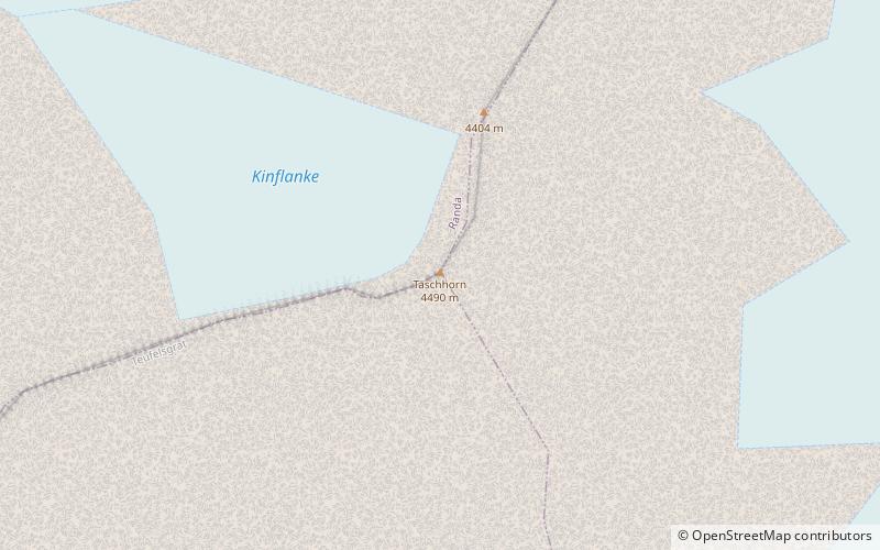
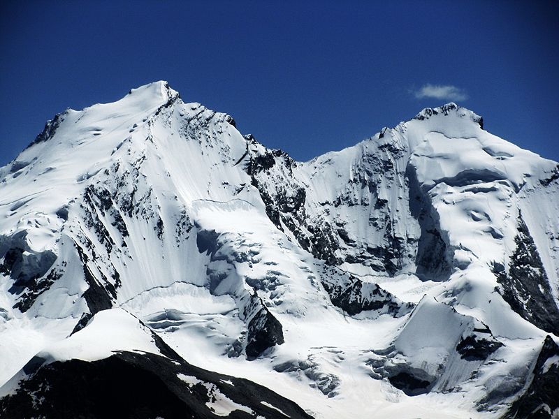
The Täschhorn is a mountain in the Pennine Alps in Switzerland, lying south of the Dom within the Mischabel range. ()
ValaisSwitzerland
Täschhorn plan & book
Unleash the traveler in you — discover the cheapest flight deals, find the perfect hotel or hostel nearby, and search for the best car rental prices. Travel at your own pace to discover new places and enjoy your journey.
Täschhorn – popular in the area (distance from the attraction)
Nearby attractions include: Dom Mountain, Europa Hut, Alphubel, Nadelhorn.
 Pennine peak first climbed in 1858
Dom Mountain
19 min walk • Dom Mountain, rising majestically in the Swiss Alps, is a breathtaking natural wonder that commands respect and admiration. At 4,545 meters, it is the highest mountain situated entirely within Switzerland and the third highest in the Alps.
 Hiking, Alpine hut
Europa Hut
74 min walk • Nestled in the Pennine Alps of Switzerland, the Europa Hut serves as a beacon of respite for intrepid alpine adventurers. This alpine hut, perched at an elevation that commands respect and awe, offers shelter and warmth amidst the rugged beauty of the Swiss mountains.
 Nature, Natural attraction, Mountain
Alphubel
37 min walk • The Alphubel is a mountain of the Swiss Pennine Alps, located between the valleys of Zermatt and Saas in the canton of Valais. It is part of the Allalin Group, a subgroup of the Mischabel Group, which culminates at the Dom.
 Nature, Natural attraction, Mountain
Nadelhorn
46 min walk • The Nadelhorn is a mountain in the Pennine Alps in Switzerland. It is the highest point on the Nadelgrat, a high-level ridge running roughly north–south above the resort of Saas-Fee to the east, and the Mattertal to the west.
 Nature, Natural attraction, Mountain
Feechopf
70 min walk • The Feechopf is a mountain of the Swiss Pennine Alps, located near Saas Fee in the canton of Valais. It lies between the Alphubel and the Allalinhorn.
 Alpine hut, Hiking
Dom Hut
60 min walk • The Dom Hut is a mountain hut of the Swiss Alpine Club, located above Randa in the canton of Valais. The hut lies on the western sloped of the Dom, at a height of 2,940 m above sea level, near the bottom of the Festigletscher glacier in the Pennine Alps.
 Nature, Natural attraction, Mountain
Lenzspitze
40 min walk • The Lenzspitze is a 4,294-metre mountain in the Pennine Alps in Switzerland. It is the southernmost peak on the Nadelgrat, a high-level ridge running roughly north–south, north of Dom in the Mischabel range, above the resort of Saas Fee to the east, and the Mattertal to the west.
 Nature, Natural attraction, Mountain
Längfluh
51 min walk • The Längfluh is a rocky outcrop of the Pennine Alps, dividing the Fee Glacier above Saas Fee in the canton of Valais. The Längfluh is accessible by cable car and is part of a ski area.
 Bridge
Charles Kuonen Suspension Bridge, Randa
74 min walk • The Charles Kuonen Suspension Bridge is the third longest hanging bridge for pedestrian use in the world. It is located in Randa, Switzerland and replaced the defunct Europabrücke, which had been damaged by a rock slide.
 Alpine hut, Hiking
Mischabel Hut
60 min walk • The Mischabel Hut is a mountain hut of the Academic Alpine Club of Zurich, located west of Saas Fee in the canton of Valais. It lies at a height of 3,340 metres above sea level near the Hohbalmgletscher glacier, on the eastern flanks of the Dom and the Lenzspitze in the Mischabel group.
 Nature, Natural attraction, Mountain
Ulrichshorn
65 min walk • The Ulrichshorn is a mountain of the Swiss Pennine Alps, overlooking Saas-Fee in the canton of Valais. It is located north of the Nadelhorn, in the Mischabel range, which lies between the Mattertal and the Saastal.


