Torre Fiorenzana
#856 among destinations in Switzerland
![Torre Fiorenzana location map](https://tzmedia.b-cdn.net/media/images/static-maps/ch/46_2502_9_15018.jpg)
Facts and practical information
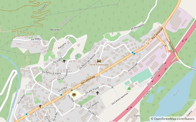
Torre Fiorenzana is a castle in the municipality of Grono of the Canton of Graubünden in Switzerland. It is a Swiss heritage site of national significance. ()
Torre Fiorenzana – popular in the area (distance from the attraction)
Nearby attractions include: Santa Maria in Calanca Castle, Lago di Cama, Pizzo di Claro, Pala Castle.
0.9 miNForts and castlesSanta Maria in Calanca Castle
22 min walk • Santa Maria in Calanca Castle is a tower in the municipality of Santa Maria in Calanca of the Canton of Graubünden in Switzerland. It, along with the neighboring Church of the Assumption of St. Mary, are both Swiss heritage sites of national significance.
3.7 miENature, Natural attraction, LakeLago di Cama
94 min walk • Lago di Cama is a lake in the Cama valley, a side valley of Val Mesolcina in the Grisons, Switzerland.
5.5 miNWNature, Natural attraction, MountainPizzo di Claro
141 min walk • Pizzo di Claro is a 2,727 metres high mountain of the Lepontine Alps, located on the border between the Swiss cantons of Ticino and Graubünden. It overlooks Claro on its western side, although Cresciano is closer. On its eastern side it overlooks the valley of Calanca near Arvigo.
2.3 miWForts and castlesPala Castle, San Vittore
58 min walk • Pala Castle is a tower in the municipality of San Vittore of the Canton of Graubünden in Switzerland. It is a Swiss heritage site of national significance.
2.6 miNEForts and castlesNorantola Castle
67 min walk • Norantola Castle is a ruined castle in the municipality of Cama of the Canton of Graubünden in Switzerland.
4.2 miWHiking, Alpine hutCapanna Brogoldone, Lumino
109 min walk • Capanna Brogoldone is a refuge in the Adula Alps at 1904 m above sea level. It is located in the territory of the municipality of Lumino in the Swiss canton of Ticino. According to the SOIUSA classification, the area belongs to the Lepontine Alps.
5.5 miWChurchClaro Abbey, Bellinzona
140 min walk • Nestled in the heart of Bellinzona, the capital of Switzerland's Ticino canton, stands the serene and historic Claro Abbey. This sacred structure, steeped in religious significance, offers a tranquil retreat from the bustling city life.
3.5 miENature, Natural attraction, MountainPizzo Paglia
90 min walk • Pizzo Paglia is a mountain of the Lepontine Alps, overlooking the Val Cama in the canton of Graubünden. The border with Italy runs 300 metres south of the summit.
2 miSWNeighbourhoodMoesa District, San Vittore
51 min walk • Moesa District, often referred to as Moesano, is a former administrative district in the canton of Graubünden, Switzerland. It had an area of 473.74 km² corresponding to the Val Mesolcina, the valley of the eponymous Moesa River.
4.9 miENature, Natural attraction, MountainPiz de Cressim
126 min walk • Piz de Cressim is a mountain of the Lepontine Alps on the Swiss-Italian border. On its west side lies the Val Cama and on its east side lies the Valle Bodengo. It is popular among climbers and mountain walkers.
4.6 miSNature, Natural attraction, MountainCorno di Gesero
117 min walk • The Corno di Gesero is a mountain of the Lepontine Alps, located on the border between the Swiss cantons of Ticino and Graubünden. It lies on the range west of the Cima di Cugn, between the Valle d'Arbedo and the Val Traversagna.