Rebra
#72 among destinations in Ukraine

Facts and practical information
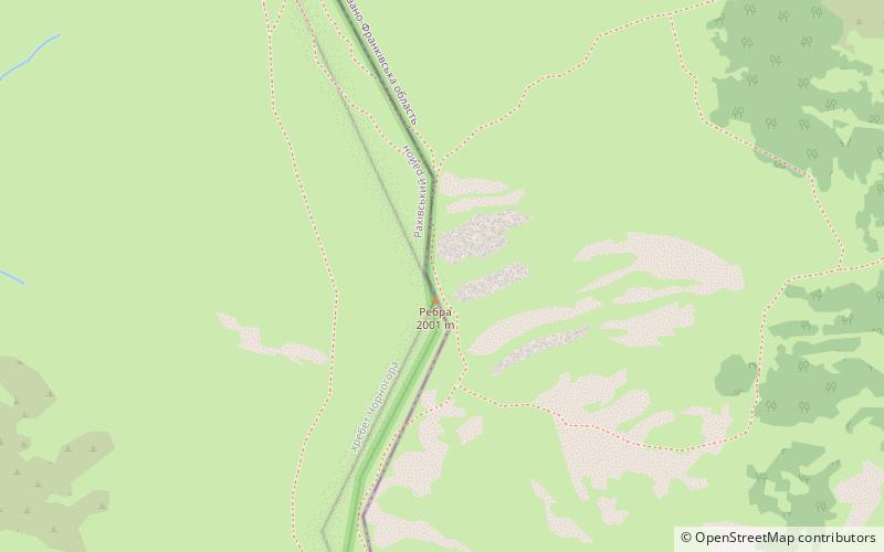
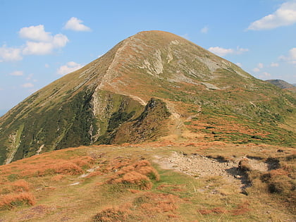
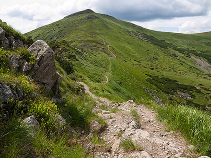
Rebra is a peak in the Chornohora region of Ukraine, with height of 2,001 meters above sea level. ()
TranscarpathiaUkraine
Rebra plan & book
Unleash the traveler in you — discover the cheapest flight deals, find the perfect hotel or hostel nearby, and search for the best car rental prices. Travel at your own pace to discover new places and enjoy your journey.
Rebra – popular in the area (distance from the attraction)
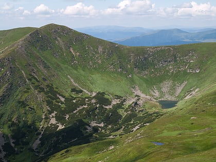
Nearby attractions include: Hoverla, Pip Ivan, Turkul, Hutyn Tomnatyk.
 Natural attraction, Mountain, Nature and wildlife
Hoverla, Carpathian Biosphere Reserve
111 min walk • Hoverla, the highest peak in Ukraine, is an emblematic feature of the Carpathian Biosphere Reserve, offering an exceptional hiking experience for adventurers and nature enthusiasts. Standing at an elevation of 2,061 meters, this mountain is not only a physical summit...
 Nature, Natural attraction, Mountain
Pip Ivan
140 min walk • Pip Ivan, a majestic peak in the Carpathian Mountains of Ukraine, stands as a sentinel at an elevation of 2,022 meters. This mountain is not only a geographical landmark but also a site steeped in history and natural beauty.
 Natural attraction, Nature, Mountain
Turkul, Carpathian Biosphere Reserve
41 min walk • Turkul is a 1,933-metre peak located in the Chornohora mountain range of Carpathian Mountains in west Ukraine. It is situated between the Dancer in the north and Rebra in the south-east.
 Natural attraction, Nature, Mountain
Hutyn Tomnatyk, Carpathian Biosphere Reserve
22 min walk • Hutyn Tomnatyk is a peak in the Chornohora region of Ukraine, with height of 2,016 meters above sea level.
 Nature, Natural attraction, Mountain
Brebeneskul
35 min walk • Brebeneskul is a peak in the Chornohora region of Ukraine, with height of 2,035 meters above sea level. The second highest peak of Ukraine.
 Nature, Natural attraction, Mountain
Menchul
57 min walk • Menchul, also Manchul, is a peak in the Chornohora region of Ukraine, with height of 1,998 meters above sea level. It lies to the southeast of the village of Vilshany in the Uholsko-Shyrokoluzhanskyi Massif of the Carpathian Mountains.
 Observatories and planetariums
Biały Słoń
146 min walk • Biały Słoń is a Polish name for an abandoned campus of the former Polish Astronomical and Meteorological Observatory of Warsaw University, located at remote area on the peak of Pip Ivan in the Chornohora range of the Carpathian Mountains, Ukraine.
 Nature, Natural attraction, Mountain
Pip Ivan
56 min walk • Pip Ivan is a peak in the Maramureș region on the Ukrainian-Romanian border, with height of 1,938 meters above sea level.
 Natural attraction, Natural feature, Nature
Chornohora, Carpathian Biosphere Reserve
110 min walk • Chornohora is the highest mountain range in Western Ukraine. It is within the Polonynian Beskids, a subgroup of the mountain group of Eastern Beskids, which in turn is part of the Outer Eastern Carpathians.
 Natural attraction, Nature, Natural feature
Eastern Beskids, Carpathian Biosphere Reserve
110 min walk • The Eastern Beskids or Eastern Beskyds are a geological group of mountain ranges of the Beskids, within the Outer Eastern Carpathians.
 Nature, Mountain
Spici 1863m
28 min walk • Shpitsy is one of the peaks of the mountain massif Chornogora. It is located in Verkhovyna district of Ivano-Frankivsk region, within the Carpathian National Nature Park.


