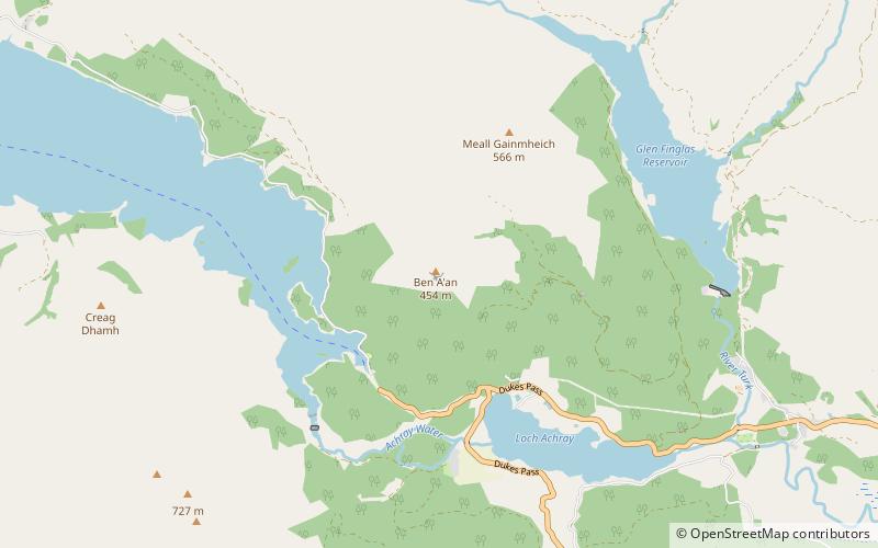
Ben A'an, Callander
#2 among attractions in Callander

Facts and practical information
Ben A'an is a hill in the Trossachs in Scotland. The pointed peak of its west top resembles a small mountain. ()
Callander plan & book
Unleash the traveler in you — discover the cheapest flight deals, find the perfect hotel or hostel nearby, and search for the best car rental prices. Travel at your own pace to discover new places and enjoy your journey.
Ben A'an – popular in the area (distance from the attraction)
Nearby attractions include: Falls of Leny, Ben Ledi, Loch Katrine, Loch Ard.
 Nature, Natural attraction, Waterfall
Falls of Leny, Callander
143 min walk • The Falls of Leny are a series of waterfalls in the Trossachs of Scotland on the course of the Garbh Uisge, otherwise known as the River Leny, where the river crosses the Highland Boundary Fault.
 Nature, Natural attraction, Mountain
Ben Ledi, Loch Lomond and The Trossachs National Park
99 min walk • Ben Ledi is a mountain in Stirling, Scotland. It is 879 metres high, and is therefore classified as a Corbett. It lies about six kilometres northwest of Callander, near the village of Kilmahog.
 Storied reservoir with boating and fishing
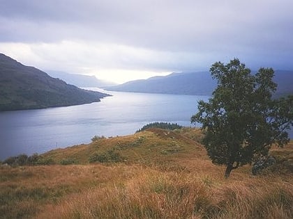
Loch Katrine, Loch Lomond and The Trossachs National Park
101 min walk • Loch Katrine is a freshwater lake in the Trossachs area of the Scottish Highlands, east of Loch Lomond, within the historic county and registration county of Perthshire and the contemporary district of Stirling.
 Nature, Lake, Scenic walking areas
Loch Ard, Aberfoyle
118 min walk • Loch Ard is a loch, located in Loch Lomond and the Trossachs National Park, Stirling council area, Scotland.
 Nature, Natural attraction, Lake
Loch Lubnaig, Loch Lomond and The Trossachs National Park
143 min walk • Loch Lubnaig is a small freshwater loch near Callander in the Stirling council area, Scottish Highlands. It lies in the former county of Perthshire. It is part of the Loch Lomond and The Trossachs National Park. The loch nestles in the space between Ben Ledi and Ben Vorlich.
 Nature, Natural attraction, Mountain
Craigmore Hill, Loch Lomond and The Trossachs National Park
98 min walk • Craigmore is a prominent hill, 387 metres high, above the village of Aberfoyle in the council area of Stirling in Scotland.
 Park
ParkQueen Elizabeth Forest Park, Loch Lomond and The Trossachs National Park
132 min walk • Queen Elizabeth Forest Park is a 19,665-hectare forest park in the Scottish Highlands which extends from the eastern shores of Loch Lomond to the mountains of Strathyre.
 Nature, Natural attraction, Mountain
Ben Venue, Loch Lomond and The Trossachs National Park
55 min walk • Ben Venue is a mountain in the Trossachs area of Scotland. The name Ben Venue is derived from the Scottish Gaelic words meaning "the miniature mountain".
 Nature, Natural attraction, Lake
Loch Chon, Loch Lomond and The Trossachs National Park
137 min walk • Loch Chon is a freshwater lake situated west of the village of Aberfoyle, near the small village of Kinlochard, Stirling, Scotland, UK. Loch Chon lies upstream of Loch Ard and to the south of Loch Katrine. In the past, Loch Chon was known as Loch-a-Choin - loch of the dog/dogs.
 Nature, Natural attraction, Lake
Loch Drunkie, Loch Lomond and The Trossachs National Park
87 min walk • Loch Drunkie is a small freshwater loch in the Trossachs near Aberfoyle in the Stirling council area, Scotland.
 Nature, Natural attraction, Forest
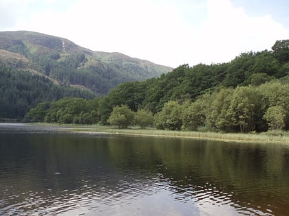
Glen Finglas, Loch Lomond and The Trossachs National Park
60 min walk • Glen Finglas is a glen in the Trossachs, in the Stirling council area of Scotland. It is an area of forest in Highlands of the former county of Perthshire, north of Brig o' Turk, close to Callander in Menteith. To the west is Loch Katrine.


