Ben Vorlich, Ardlui
#1 among attractions in Ardlui
![Ben Vorlich location map](https://tzmedia.b-cdn.net/media/images/static-maps/gb/56_274_-4_75496.jpg)
Facts and practical information
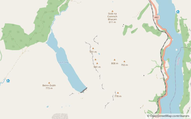
Ben Vorlich is a Scottish mountain situated between the northernmost section of Loch Lomond and Loch Sloy. It is one of the Arrochar Alps, though it lies separate from the other peaks in the range, as indicated by the large topographic prominence. It is the highest point of the historic county of Dunbartonshire. ()
Ardlui United Kingdom
Ardlui plan & book
Unleash the traveler in you — discover the cheapest flight deals, find the perfect hotel or hostel nearby, and search for the best car rental prices. Travel at your own pace to discover new places and enjoy your journey.
Ben Vorlich – popular in the area (distance from the attraction)
Nearby attractions include: The Cobbler, Beinn Narnain, Ben Vane, Falls of Falloch.
4.7 miSWDistinctive mountain reaching 884m highThe Cobbler, Tarbet
120 min walk • The Cobbler is an 884 metres mountain located near the head of Loch Long in Argyll and Bute, Scotland. It is a Corbett, and is an important site for rock climbing in the Southern Highlands.
3.9 miSNature, Natural attraction, MountainBeinn Narnain, Loch Lomond and The Trossachs National Park
99 min walk • Beinn Narnain is a mountain in the southern Highlands of Scotland, near Arrochar. It forms part of a group of hills known as the Arrochar Alps, and is a Munro. The name Beinn Narnain means "hill of notches", and describes the mountain's notched profile. Beinn Narnain is usually climbed from Succoth at the head of Loch Long.
2 miSWNature, Natural attraction, MountainBen Vane, Loch Lomond and The Trossachs National Park
51 min walk • Ben Vane is a Scottish mountain situated in the southern Highlands. The underlying geology almost entirely comprises the Beinn Bheula Schist Formation - psammite and pelite with a Siluro-Devonian dyke prominent round the northern and eastern face.
5.8 miNENatural attraction, Park, View pointFalls of Falloch, Loch Lomond and The Trossachs National Park
147 min walk • Falls of Falloch is a waterfall and local beauty spot on the river Falloch off the A82. It is 7 km south-west of the village of Crianlarich in the county of Stirling in Scotland. It is also on the West Highland Way.
3.5 miSWNature, Natural attraction, MountainBeinn Ìme, Loch Lomond and The Trossachs National Park
90 min walk • Beinn Ìme is the highest mountain in the Arrochar Alps, in the Southern Highlands of Scotland. There are three usual routes of ascent.
2.5 miSEAreaInveruglas Isle, Loch Lomond and The Trossachs National Park
64 min walk • Inveruglas Isle is a small uninhabited island within Loch Lomond, and lies off the shore at Inveruglas opposite Inversnaid at the north end of the loch. It is opposite the Loch Sloy powerstation.
3.7 miEMountainBeinn a' Chòin, Loch Lomond and The Trossachs National Park
96 min walk • Beinn a' Choin is a mountain in the Grampian Mountains of Scotland. It lies on the border of the Stirling region and Argyll at the northern end of Loch Lomond. A rugged and wild mountain of rocks and moorland lying north of Ben Lomond, it usually climbed from the small settlement of Inversnaid.
2.2 miEAreaIsland I Vow, Loch Lomond and The Trossachs National Park
57 min walk • Eilean I Vow is a small island in Loch Lomond in west central Scotland. Other variants of the name include Ellan I Vow, Eilean a' Vow, Elanvow, Ellan Vhow and Island I Vow. The island is listed in 13th/14th century charters as "Elanvow". It is opposite Rubha Bàn, a point on the mainland, and north of Inveruglas Isle.
4.9 miSEAreaTarbet Isle, Loch Lomond and The Trossachs National Park
124 min walk • Tarbet Isle is an island in Loch Lomond, Scotland. It is off Tarbet on the mainland. It is 10 feet at its highest point, and 80 metres long.
4.2 miWNature, Natural attraction, MountainBinnein an Fhidhleir
107 min walk • Binnein an Fhidhleir, one of the Arrochar Alps, is a mountain in southern Scotland. It is located above Butterbridge on the north side the A83 road facing Beinn an Lochain to the south.
3 miSNature, Natural attraction, MountainA' Chrois, Tarbet
77 min walk • A' Chrois is a mountain located in the Arrochar Alps north west of Arrochar in Argyll, an extremely scenic area which is technically in the highlands although it is within easy reach of the heavily populated areas of Glasgow.