St Lawrence's Church, Long Buckby
#1 among attractions in Long Buckby
Facts and practical information
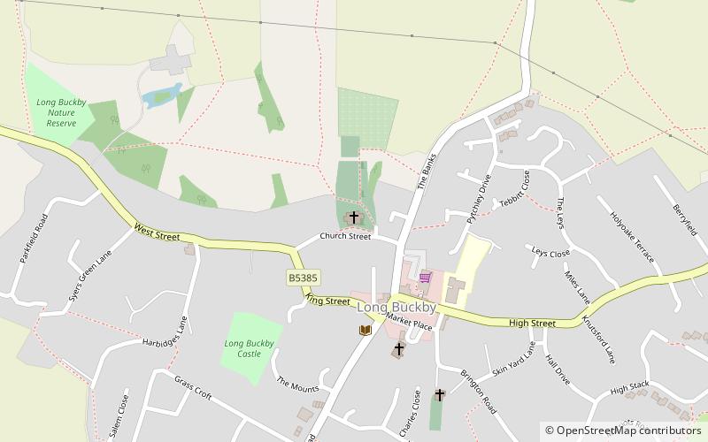
St Lawrence's Church is an Anglican Church and the parish church of Long Buckby. It is a Grade II* listed building and stands on the north side of Church Street. ()
St Lawrence's Church – popular in the area (distance from the attraction)
Nearby attractions include: Althorp, Northampton Golf Club, Cottesbrooke Hall, Drayton Reservoir.
3.8 miSEMuseum, History museum, Vernacular architectureAlthorp, Northampton
98 min walk • Althorp, nestled in the verdant countryside of Northamptonshire, is a stately home and estate that exudes the quintessential charm of the English aristocracy. This historical gem has been the ancestral home of the Spencer family for over 500 years, and it gained...
5 miSEGolfNorthampton Golf Club
127 min walk • Nestled in the rolling landscape of Northamptonshire, Northampton Golf Club offers a premier golfing experience in the heart of England. Established in 1893, this prestigious club has a rich history and is renowned for its challenging yet fair 18-hole course.
6.5 miNEMuseum, History museum, GardenCottesbrooke Hall, Northampton
165 min walk • Cottesbrooke Hall and the Cottesbrooke estate in Northamptonshire, England is a Grade I listed country house and estate.
4.1 miSWNatural attraction, Body of water, ParkDrayton Reservoir, Daventry
106 min walk • Drayton Reservoir is a reservoir in Daventry, Northamptonshire, England. The reservoir is accessible from the A361 near the northern edge of Daventry. Drayton Reservoir is a feeder reservoir for the Grand Union Canal. When water is required for the canal the water level at Drayton can drop by 30 cm or more in a day.
3.9 miSWParkDaventry Country Park, Daventry
100 min walk • Daventry Country Park is a 66-hectare Local Nature Reserve and country park on the north-eastern outskirts of Daventry in Northamptonshire, England. It is owned and managed by West Northamptonshire Council.
4.2 miSWForts and castlesBorough Hill
108 min walk • Borough Hill is a hill to the east of the town of Daventry in the English county of Northamptonshire. It is over 200 metres above sea level and dominates the surrounding area.
7.8 miSWForts and castlesArbury Hill
198 min walk • Arbury Hill, at 225 m, is the joint highest point in the English county of Northamptonshire. It is 9 km southwest of the town of Daventry.
4.6 miSW 6.8 miSEVillage, AreaKislingbury, Northampton
173 min walk • Kislingbury is a village in Northamptonshire, England, about 4 miles west of Northampton town centre, and close to junctions 15A and 16 of the M1 motorway. The villages name origin is uncertain. 'At the gravelly-place fortification' or perhaps, 'at the fortification of Cysel's people'.
2.6 miNChurchAll Saints' Church, West Haddon
65 min walk • All Saints' Church is an Anglican church and the parish church of West Haddon, Northamptonshire. It is a Grade I listed building and stands on the north side of the High Street. There is no reference to a church or priest in the entry for West Haddon in the Domesday Book.
3.9 miSWVernacular architecture, Archaeological siteBorough Hill Roman villa
99 min walk • Borough Hill Roman villa is located on the north tip of Borough Hill, a prominent hill near the town of Daventry in Northamptonshire. The villa’s remains lie within the ramparts of an Iron Age fortress which covers the summit of the hill.