Llyn-y-Foel, Snowdonia National Park
#116 among attractions in Snowdonia National Park
![Llyn-y-Foel location map](https://tzmedia.b-cdn.net/media/images/static-maps/gb/53_0731_-3_91949.jpg)
Facts and practical information
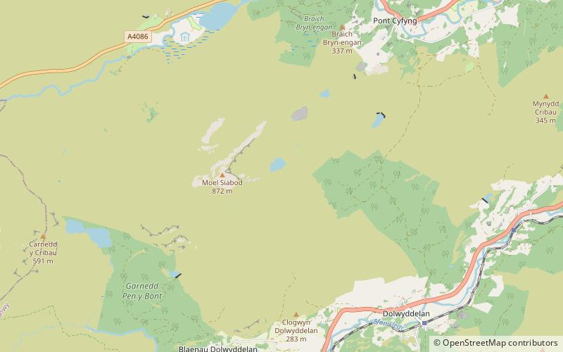
Llyn-y-Foel is a lake in Snowdonia, Wales. It is approximately 240 m across, 120 m wide and up to 2 m deep. It lies at 535m altitude at the foot of the main ridge of Moel Siabod at grid reference SH 714 547. ()
Snowdonia National Park United Kingdom
Snowdonia National Park plan & book
Unleash the traveler in you — discover the cheapest flight deals, find the perfect hotel or hostel nearby, and search for the best car rental prices. Travel at your own pace to discover new places and enjoy your journey.
Llyn-y-Foel – popular in the area (distance from the attraction)
Nearby attractions include: Plas y Brenin, Swallow Falls, Llynnau Mymbyr, Moel Siabod.
2 miNOutdoor activities, ClimbingPlas y Brenin, Capel Curig
51 min walk • Plas y Brenin, located in Conwy County Borough, Wales, is a National Outdoor Centre owned by Sport England. The centre is situated in Dyffryn Mymbyr, the Mymbyr Valley, in Snowdonia and is less than a quarter of a mile south-west of the centre of Capel Curig on the A4086 road.
3.7 miNENatural attraction, Park, WaterfallSwallow Falls, Betws-y-Coed
94 min walk • Swallow Falls is a name coined by early tourists for the Rhaeadr Ewynnol, a multiple waterfall system in Wales, located on the Afon Llugwy near Betws-y-Coed, in Conwy County Borough.
1.8 miNNature, Natural attraction, LakeLlynnau Mymbyr, Snowdonia National Park
46 min walk • Llynnau Mymbyr are two lakes located in Dyffryn Mymbyr, a valley running from the village of Capel Curig to the Pen-y-Gwryd hotel in Snowdonia, north-west Wales. The A4086 runs along their northern banks.
0.6 miWNatural attraction, MountainMoel Siabod, Capel Curig
16 min walk • Moel Siabod, is a mountain in Snowdonia, North Wales, which sits isolated above the village of Dolwyddelan. At 872 metres, it is the highest peak in the Moelwynion mountain range.
3.7 miEHistorical place, Architecture, MuseumTŷ Mawr Wybrnant, Snowdonia National Park
94 min walk • Tŷ Mawr Wybrnant is a house located in the Wybrnant Valley, in the community of Bro Machno, near Betws-y-Coed in Conwy County Borough, North Wales. It was the birthplace of Bishop William Morgan, first translator of the whole Bible into Welsh.
1.6 miSEHistorical place, View point, Forts and castlesDolwyddelan Castle, Betws-y-Coed
42 min walk • Dolwyddelan Castle is a Welsh castle located near Dolwyddelan in Conwy County Borough in North Wales. It is thought to have been built in the early 13th century by Llywelyn the Great, Prince of Gwynedd and Wales.
3.8 miNWLakeLlyn Bochlwyd, Snowdonia National Park
98 min walk • Llyn Bochlwyd is a lake in Snowdonia, Wales, in Conwy County Borough. It lies in Cwm Bochlwyd, near Llyn Ogwen in the Glyderau mountain range.
3.4 miNENature, Natural attraction, LakeLlyn Goddionduon, Snowdonia National Park
88 min walk • Llyn Goddionduon is a remote lake in the Gwydir Forest in north Wales. It lies at a height of 794 ft and covers an area of 10 acres.
2.5 miNEArchaeological siteCaer Llugwy, Snowdonia National Park
65 min walk • Caer Llugwy, or Bryn-y-Gefeiliau, is the site of a Roman fort in a loop of the Afon Llugwy near Capel Curig in Conwy, Wales. It is notable in that there has been little development in the surrounding landscape: the valley in which it is situated being much as it was 2,000 years ago.
3.2 miNWNature, Natural attraction, MountainY Foel Goch, Snowdonia National Park
83 min walk • Y Foel Goch is a mountain in Snowdonia, north-west Wales, and is a sister peak along with Gallt yr Ogof to Glyder Fach. Between Glyder Fach and its summit lies Llyn Caseg-fraith, a popular lake for photographing Tryfan and its reflection.
3.5 miWNature, Natural attraction, Mountain passPen-y-Gwryd, Snowdonia National Park
89 min walk • Pen-y-Gwryd is a pass at the head of Nantygwryd and Nant Cynnyd rivers close to the foot of Snowdon in Gwynedd, Wales. The area is located at the junction of the A4086 from Capel Curig to Llanberis and Caernarfon and the A498 from Beddgelert and Nant Gwynant about a mile from the head of the Llanberis Pass.