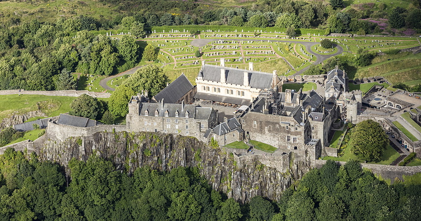
Stirling Sill, Stirling
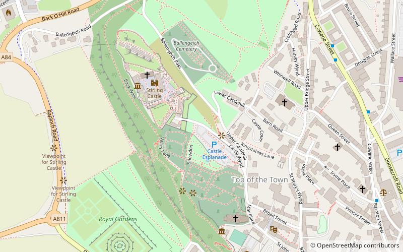
Map
Facts and practical information
The Stirling Sill is an outcropping of a large quartz-dolerite intrusion or sill that underlies a large part of central Scotland, and may be contiguous at great depth. The sill is of very late Carboniferous age or more probably Permian, as it penetrates the coal measures, often in bedding planes between the various strata. In places, it rises through fractures in the strata to a new level, forming features that, at the surface, would be called dikes. ()
Coordinates: 56°7'23"N, 3°56'46"W
Address
Stirling
ContactAdd
Social media
Add
Getting there by public transportation
Public transportation stops near this location
- Bus
- Train
 Bus
Bus
- Calculate routeStirling 13 min walk
- Calculate routeAllan Park South Church 13 min walk
- Calculate routeStirling Bus Station 15 min walk
Day trips


Frequently Asked Questions (FAQ)
Which popular attractions are close to Stirling Sill?
Nearby attractions include Statue of Robert the Bruce, Stirling (1 min walk), Stirling Castle, Stirling (3 min walk), Argyll's Lodging, Stirling (4 min walk), Mar's Wark, Stirling (4 min walk).
How to get to Stirling Sill by public transport?
The nearest stations to Stirling Sill:
Train
Bus
Train
- Stirling (13 min walk)
Bus
- Allan Park South Church • Lines: B12 (13 min walk)
- Stirling Bus Station • Lines: 24, B12, C11, X39 (15 min walk)