Broxbourne Woods

Gallery (1)
Map
Map
Facts and practical information
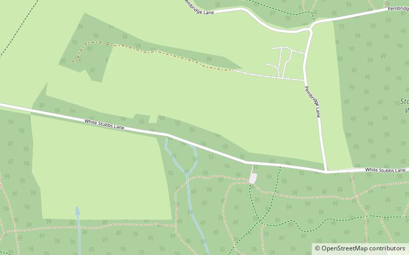
Broxbourne Woods are a 239.1 hectare National Nature Reserve west of Broxbourne in Hertfordshire. The site is Hertfordshire's only National Nature Reserve, and is also a Special Area of Conservation. It covers Hoddesdonpark Wood, Wormley Wood, Broxbourne Wood and Bencroft Wood. Bencroft and Broxbourne are owned by Hertfordshire County Council, and Hoddesdonpark and Wormley Woods by the Woodland Trust. They are all in Sites of Special Scientific Interest; Wormley Wood and Bencroft Wood form almost all of Wormley-Hoddesdonpark Wood South, and Hoddesdonpark Wood and Broxbourne Wood are part of Wormley-Hoddesdonpark Wood North. ()
Elevation: 335 ft a.s.l.Coordinates: 51°44'33"N, 0°4'55"W
Location
England
ContactAdd
Social media
Add
Day trips