The White Horse, Hertford
Map
Facts and practical information
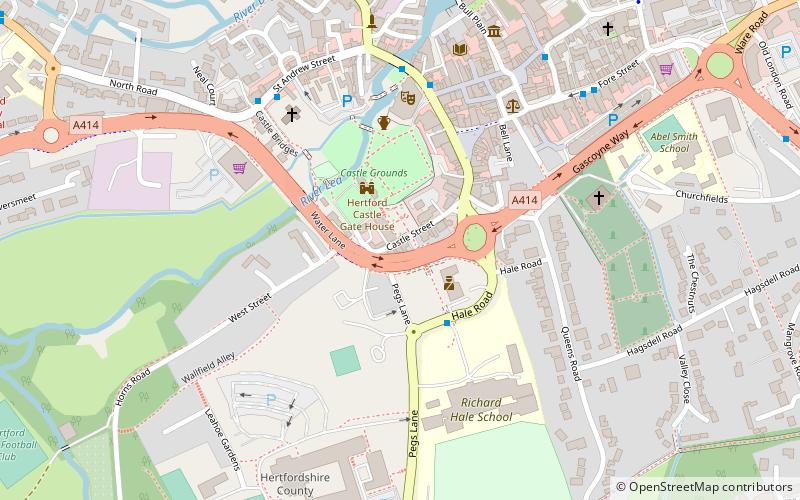
The White Horse is a public house on the south side of Castle Street, Hertford. England. The pub occupies numbers 31 and 33 Castle Street, two of a group of three grade II listed houses that also includes number 35. The timber-framed buildings date from the sixteenth and seventeenth centuries with later additions. The pub is under the management of Fullers Brewery. ()
Coordinates: 51°47'40"N, 0°4'48"W
Getting there by public transportation
Public transportation stops near this location
- Bus
- Train
 Bus
Bus
- Calculate routeBus Station 8 min walk
- Calculate routeHertford Bus Station 8 min walk
- Calculate routeHertford East 12 min walk
- Calculate routeHertford North 16 min walk
Day trips


Frequently Asked Questions (FAQ)
Which popular attractions are close to The White Horse?
Nearby attractions include Shire Hall, Hertford (5 min walk), St Andrew Street, Hertford (5 min walk), All Saints' Church, Hertford (5 min walk), Hertford Museum, Hertford (6 min walk).
How to get to The White Horse by public transport?
The nearest stations to The White Horse:
Bus
Train
Bus
- Bus Station • Lines: 10, 724 (8 min walk)
- Hertford Bus Station (8 min walk)
Train
- Hertford East (12 min walk)
- Hertford North (16 min walk)