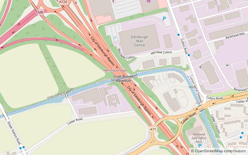
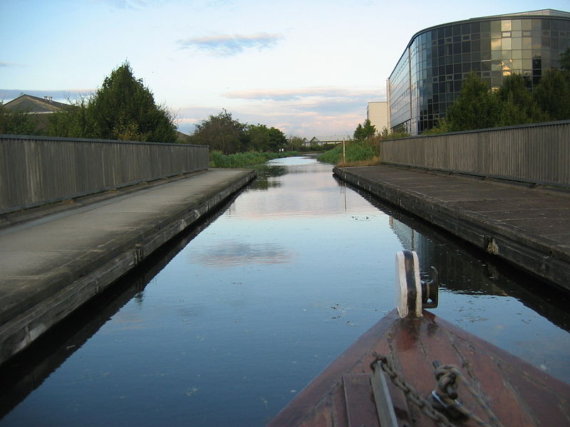
Scott Russell Aqueduct, Edinburgh

Gallery (3)
Map
Map
Gallery
Facts and practical information
The Scott Russell Aqueduct is an aqueduct carrying the Union Canal over the Edinburgh City Bypass, west of Edinburgh, Scotland. ()
Coordinates: 55°55'18"N, 3°18'26"W
Getting there by public transportation
Public transportation stops near this location
- Bus
- Tram
- Train
 Bus
Bus
- Calculate routeEdinburgh Park Station 11 min walk
- Calculate routeBankhead 19 min walk
- Calculate routeGyle Centre 32 min walk
- Calculate routeHermiston Park and Ride 11 min walk
- Calculate routeHermiston Park & Ride 11 min walk
- Calculate routeSouth Gyle Crescent Lane 16 min walk
- Calculate routeBankhead Loan 16 min walk
- Calculate routeEdinburgh Park 11 min walk
- Calculate routeWester Hailes 27 min walk
- Calculate routeSouth Gyle 28 min walk
Day trips


Frequently Asked Questions (FAQ)
Which popular attractions are close to Scott Russell Aqueduct?
Nearby attractions include Bankhead, Edinburgh (11 min walk), The Calders, Edinburgh (13 min walk), Sighthill, Edinburgh (18 min walk), South Gyle, Edinburgh (24 min walk).
How to get to Scott Russell Aqueduct by public transport?
The nearest stations to Scott Russell Aqueduct:
Tram
Bus
Train
Tram
- Edinburgh Park Station • Lines: Edinburgh Trams Eastbound, Edinburgh Trams Westbound (11 min walk)
- Bankhead • Lines: Edinburgh Trams Eastbound, Edinburgh Trams Westbound (19 min walk)
Bus
- Hermiston Park and Ride (11 min walk)
- Hermiston Park & Ride • Lines: 25 (11 min walk)
Train
- Edinburgh Park (11 min walk)
- Wester Hailes (27 min walk)