Trek Zone

Churchbridge Junction, Cannock

#9 among attractions in Cannock

Sightseeing
Churchbridge Junction location map
Map

Facts and practical information
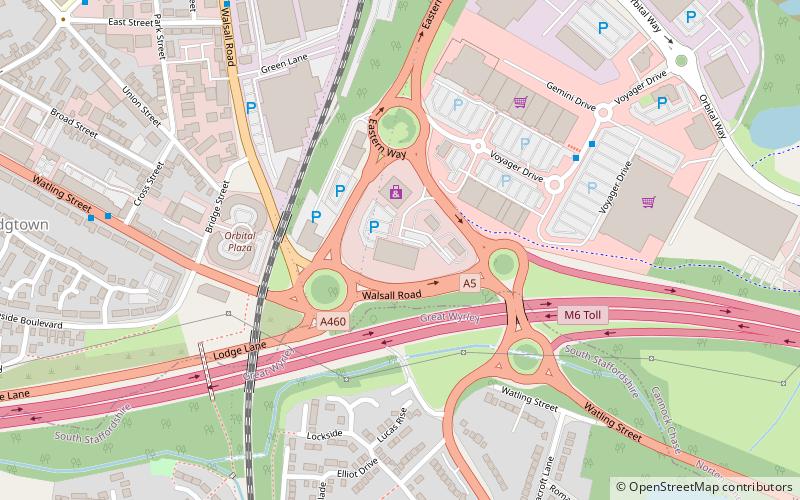
Coordinates: 52°40'24"N, 2°1'18"W
Address

Cannock United Kingdom

ContactAdd
Social media
Add
Day trips

Churchbridge Junction – popular in the area (distance from the attraction)

Nearby attractions include: Hednesford Hills Raceway, Moseley Old Hall, Designer Outlet West Midlands, Hednesford.

  • hednesford hills raceway location map
    3.1 miNE
  • moseley old hall wolverhampton4.2 miSW
  • designer outlet west midlands cannock location map
    1.1 miN
  • hednesford cannock2.8 miN
  • st marks church cannock0.5 miS
  • watling street brownhills4.1 miE
  • forest of mercia3.4 miE
  • gailey reservoirs3.4 miW
  • great wyrley cannock0.8 miS
  • bloxwich walsall4.1 miS
  • pelsall junction3.2 miSE

Frequently Asked Questions (FAQ)

Which popular attractions are close to Churchbridge Junction?

Nearby attractions include St Mark's Church, Cannock (13 min walk), Great Wyrley, Cannock (20 min walk).

Where to next? Visit england England region page or discover the top tourist attractions in United Kingdom.