Parkhead Viaduct, Dudley

Gallery (1)
Map
Map
Facts and practical information
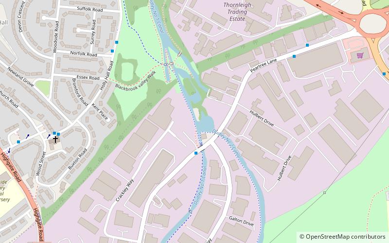
Parkhead Viaduct is a railway viaduct in Dudley, West Midlands, England. The original viaduct was a wooden structure erected in 1850 to carry the Oxford, Worcester and Wolverhampton Railway over Parkhead Locks on the Dudley Canal, near to the southern mouth of the Dudley Tunnel. The current brick viaduct was built in 1880 and it is believed that the original wooden structure is still encased within its successor. ()
Completed: 1880 (146 years ago)Coordinates: 52°29'51"N, 2°5'55"W
Getting there by public transportation
Public transportation stops near this location
- Bus
 Bus
Bus
- Calculate routeHolly Hall Rd / Norfolk Rd 6 min walk
- Calculate routeCrossgate Rd / Wood Street 9 min walk
- Calculate routeBlowers Green Rd / Duncan Edwards Way 11 min walk
Day trips


Frequently Asked Questions (FAQ)
Which popular attractions are close to Parkhead Viaduct?
Nearby attractions include Church of St Andrew, Dudley (14 min walk), Pensnett Canal, Dudley (14 min walk), Netherton, Dudley (21 min walk), Church of St Thomas, Dudley (24 min walk).
How to get to Parkhead Viaduct by public transport?
The nearest stations to Parkhead Viaduct:
Bus
Bus
- Holly Hall Rd / Norfolk Rd • Lines: 8 (6 min walk)
- Crossgate Rd / Wood Street • Lines: 8 (9 min walk)