Bowden Housteads Woods, Sheffield

Gallery (1)
Map
Map
Facts and practical information
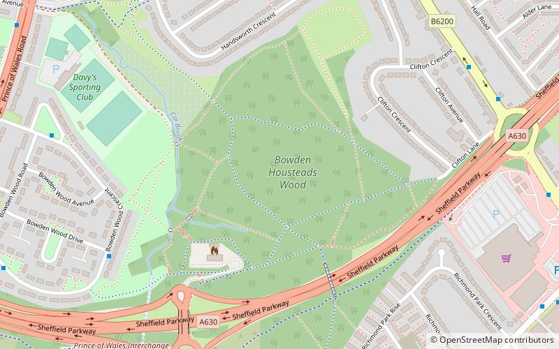
Bowden Housteads Woods are situated between Darnall and Handsworth, Sheffield, South Yorkshire, England. the woods are encircled by Sheffield Outer Ring Road, Sheffield Parkway and Handsworth Road. The woods are classified as ancient woodlands, having been in existence since the 17th century, the Car Brook flows through the wooded area. Spring brings a carpet of bluebells. The woods are a Local Nature Reserve. ()
Elevation: 325 ft a.s.l.Coordinates: 53°22'38"N, 1°24'13"W
Getting there by public transportation
Public transportation stops near this location
- Bus
- Tram
- Train
 Bus
Bus
- Calculate routeHandsworth/Sheffield Parkway 9 min walk
- Calculate routeDarnall 16 min walk
- Calculate routeAttercliffe 39 min walk
Day trips


Frequently Asked Questions (FAQ)
Which popular attractions are close to Bowden Housteads Woods?
Nearby attractions include Parkway Man, Sheffield (6 min walk), Sheffield Outer Ring Road, Sheffield (11 min walk), Handsworth Road, Sheffield (13 min walk), High Hazels Park, Sheffield (17 min walk).
How to get to Bowden Housteads Woods by public transport?
The nearest stations to Bowden Housteads Woods:
Bus
Train
Tram
Bus
- Handsworth/Sheffield Parkway • Lines: 74A (9 min walk)
Train
- Darnall (16 min walk)
Tram
- Attercliffe • Lines: Tt, Yell (39 min walk)