Wat Phra Dhammakaya Manchester, Manchester
Map
Facts and practical information
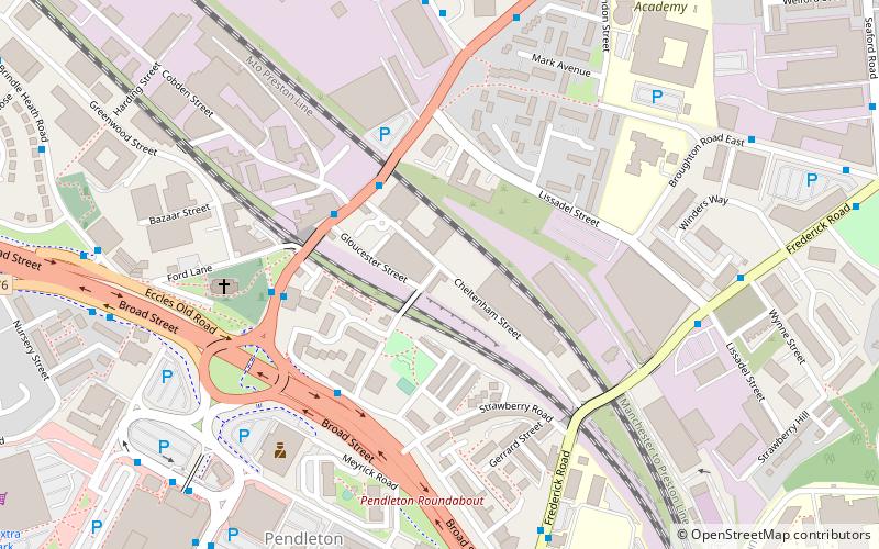
Wat Phra Dhammakaya Manchester, also known in English as the North-West Centre for Buddhist Meditation, is a Thai Buddhist temple in Salford, England. Established on 8 February 2004 in a converted curtain-rail factory, it was the first Thai Buddhist temple in the northwest of England. ()
Coordinates: 53°29'32"N, 2°16'53"W
Address
Salford (Irwell Riverside)Manchester
ContactAdd
Social media
Add
Getting there by public transportation
Public transportation stops near this location
- Bus
- Tram
- Train
 Bus
Bus
- Calculate routeBROUGHTON Road/Cobden Street 3 min walk
- Calculate routeBroad Street/Pendleton Church 4 min walk
- Calculate routeBroughton Rd/Pendleton Church 4 min walk
- Calculate routeLangley Road South/Cromwell Road 6 min walk
- Calculate routeSalford Crescent 13 min walk
- Calculate routeSalford Central 32 min walk
- Calculate routeLangworthy 26 min walk
- Calculate routeWeaste 33 min walk
Maps MetrolinkMaps
 Metrolink / Rail
MetrolinkMapsMetrolink / RailDay trips


Frequently Asked Questions (FAQ)
Which popular attractions are close to Wat Phra Dhammakaya Manchester?
Nearby attractions include St Thomas' Church, Manchester (5 min walk), Peel Park, Manchester (14 min walk), Salford, Manchester (16 min walk), Salford Museum and Art Gallery, Manchester (17 min walk).
How to get to Wat Phra Dhammakaya Manchester by public transport?
The nearest stations to Wat Phra Dhammakaya Manchester:
Bus
Train
Tram
Bus
- BROUGHTON Road/Cobden Street • Lines: 74 (3 min walk)
- Broad Street/Pendleton Church • Lines: 50 (4 min walk)
Train
- Salford Crescent (13 min walk)
- Salford Central (32 min walk)
Tram
- Langworthy • Lines: Asht, Eccl (26 min walk)
- Weaste • Lines: Asht, Eccl (33 min walk)