Corick

Gallery (2)
Map

Map
Gallery
Facts and practical information
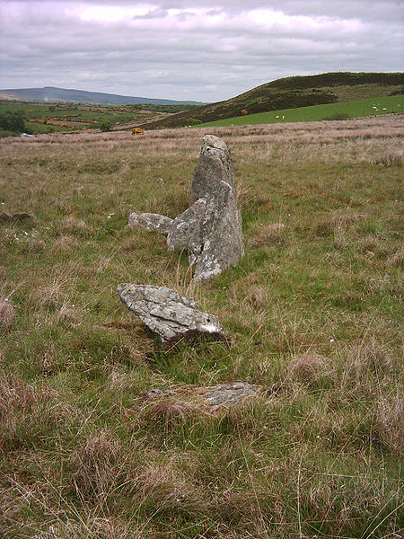
Corick is a megalithic site and townland in the civil parish of Ballynascreen, County Londonderry, Northern Ireland. It includes a stone circle and a stone row. The Corick stone circles and alignments are located 2 km north east of Ballybriest court-tomb, 400 metres south of Corick clachan, near a stream. The stone alignments and circle are Scheduled Historic Monuments in Corick at grid reference: Area of H780 896. ()
Location
Northern Ireland
ContactAdd
Social media
Add
Day trips