Cowleaze Wood

Gallery (4)
Map

Map
Gallery
Facts and practical information
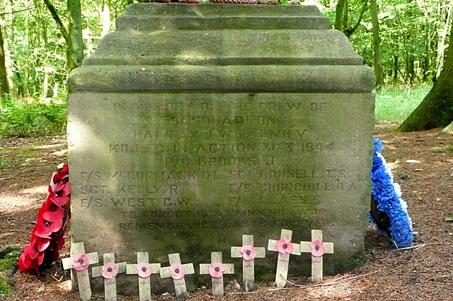
Cowleaze Wood is a 70-acre woodland in the Chiltern Hills, a chalk ridge in South East England. The wood is in the civil parish of Lewknor, in Oxfordshire, about 1+1⁄4 miles southeast of the village. It is next to the county boundary with Buckinghamshire, and adjoins Lydall's Wood on the Buckinghamshire side of the boundary. ()
Coordinates: 51°39'18"N, 0°56'42"W
Location
England
ContactAdd
Social media
Add
Day trips


