Tameside College, Ashton-under-Lyne
Map
Facts and practical information
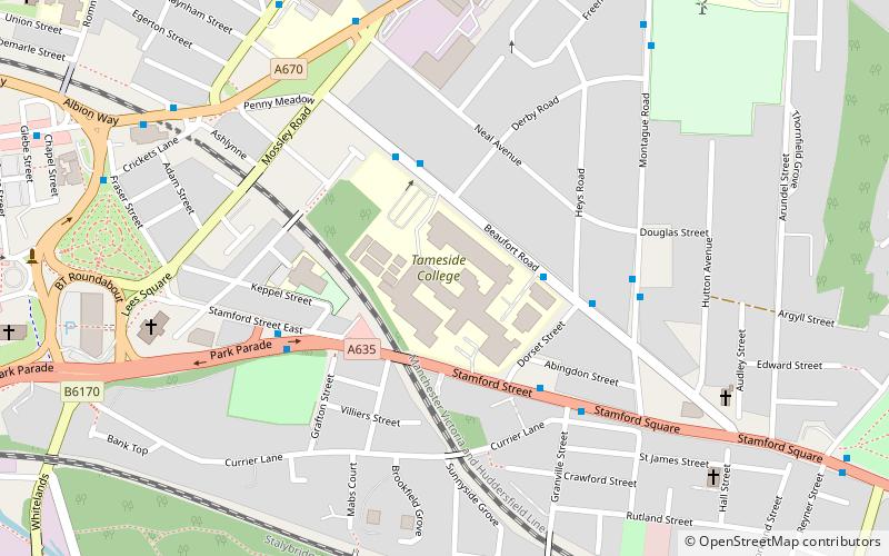
Tameside College is a further education college located in Ashton-under-Lyne, Greater Manchester, England. ()
Coordinates: 53°29'18"N, 2°4'53"W
Address
Tameside College, Beaufort RoadTameside (St. Michael's)Ashton-under-Lyne
Contact
Social media
Add
Getting there by public transportation
Public transportation stops near this location
- Bus
- Tram
- Train
 Bus
Bus
- Calculate routeStagecoach Manchester - Ashton Depot 10 min walk
- Calculate routeAshton-under-Lyne, Oldham Road / opposite Old Street 17 min walk
- Calculate routeAshton-under-Lyne Interchange 17 min walk
- Calculate routeAshton-under-Lyne 14 min walk
- Calculate routeStalybridge 20 min walk
- Calculate routeAshton-under-Lyne 18 min walk
- Calculate routeAshton West 30 min walk
Day trips


Frequently Asked Questions (FAQ)
Which popular attractions are close to Tameside College?
Nearby attractions include St Michael and All Angels' Church, Ashton-under-Lyne (9 min walk), Grade I listed churches in Greater Manchester, Ashton-under-Lyne (9 min walk), Ashton Town Hall, Tameside (13 min walk), Stamford Park, Stalybridge (15 min walk).
How to get to Tameside College by public transport?
The nearest stations to Tameside College:
Bus
Train
Tram
Bus
- Stagecoach Manchester - Ashton Depot (10 min walk)
- Ashton-under-Lyne, Oldham Road / opposite Old Street • Lines: 330 (17 min walk)
Train
- Ashton-under-Lyne (14 min walk)
- Stalybridge (20 min walk)
Tram
- Ashton-under-Lyne • Lines: Asht, Eccl, Mcuk (18 min walk)
- Ashton West • Lines: Asht, Eccl, Mcuk (30 min walk)