National Squash Centre, Manchester
Map
Facts and practical information
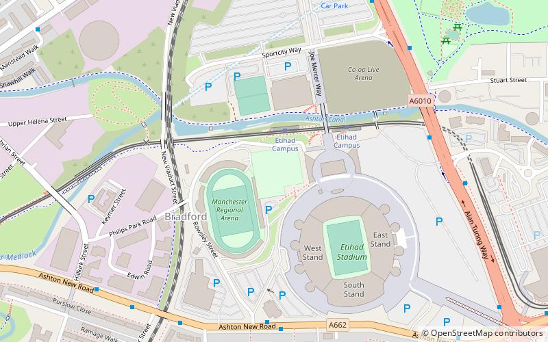
The National Squash Centre is a squash venue in Eastlands, Manchester, England, which was constructed for the 2002 Commonwealth Games. The National Squash Centre is part of the Sportcity complex. ()
Coordinates: 53°29'5"N, 2°12'10"W
Address
Rowsley StreetBradfordManchester M11 3FF
ContactAdd
Social media
Add
Getting there by public transportation
Public transportation stops near this location
- Bus
- Tram
- Train
 Bus
Bus
- Calculate routeEtihad Campus 2 min walk
- Calculate routeHolt Town 11 min walk
- Calculate routeVelopark 11 min walk
- Calculate routeNew Islington 19 min walk
- Calculate routeAlan Turing Way/Philips Park Road 6 min walk
- Calculate routeAshburys 24 min walk
- Calculate routeArdwick 27 min walk
- Calculate routeManchester Piccadilly 32 min walk
Maps MetrolinkMaps
 Metrolink / Rail
MetrolinkMapsMetrolink / RailDay trips


Frequently Asked Questions (FAQ)
Which popular attractions are close to National Squash Centre?
Nearby attractions include Beswick, Manchester (9 min walk), Philips Park, Manchester (12 min walk), Hope Mill, Manchester (15 min walk), Church of All Souls, Manchester (16 min walk).
How to get to National Squash Centre by public transport?
The nearest stations to National Squash Centre:
Tram
Bus
Train
Tram
- Etihad Campus • Lines: Asht, Eccl, Mcuk (2 min walk)
- Holt Town • Lines: Asht, Eccl, Mcuk (11 min walk)
Bus
- Alan Turing Way/Philips Park Road • Lines: 53 (6 min walk)
Train
- Ashburys (24 min walk)
- Ardwick (27 min walk)