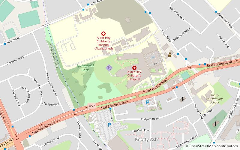
Springfield Park, Liverpool
Map
Facts and practical information
Springfield Park is a 22-acre park in Liverpool, England. ()
Created: 1907Elevation: 144 ft a.s.l.Coordinates: 53°25'6"N, 2°53'53"W
Address
Knotty AshLiverpool
ContactAdd
Social media
Add
Getting there by public transportation
Public transportation stops near this location
- Train
 Train
Train
- Calculate routeBroad Green 22 min walk
- Calculate routeWavertree Technology Park 35 min walk
Day trips


Frequently Asked Questions (FAQ)
Which popular attractions are close to Springfield Park?
Nearby attractions include St John the Evangelist, Liverpool (9 min walk), Doric Park, Liverpool (14 min walk), Church of St Paul, Liverpool (18 min walk), St Oswald's Church, Liverpool (21 min walk).
How to get to Springfield Park by public transport?
The nearest stations to Springfield Park:
Train
Train
- Broad Green (22 min walk)
- Wavertree Technology Park (35 min walk)