Stoneycroft, Liverpool
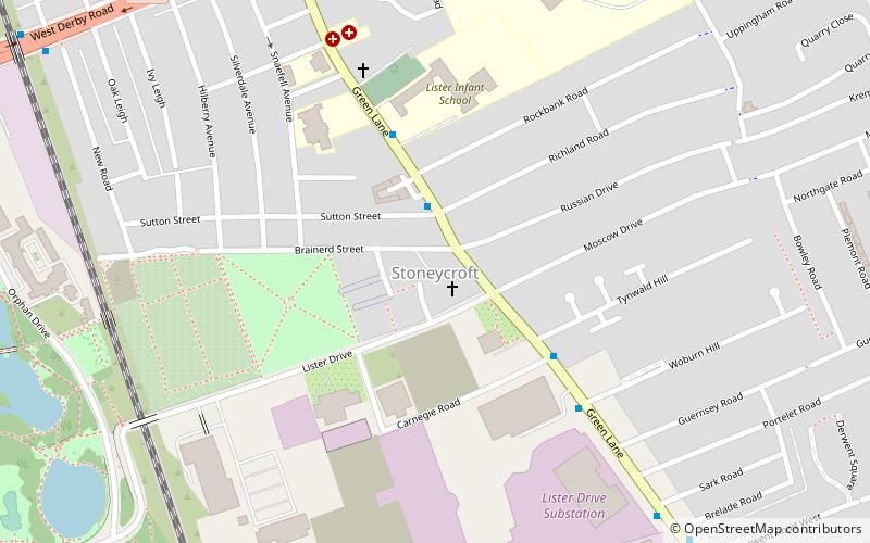
Map
Facts and practical information
Stoneycroft is small leafy district in the east of Liverpool, England and part of the Tuebrook and Stoneycroft and Old Swan wards. ()
Coordinates: 53°25'17"N, 2°55'37"W
Address
Tuebrook and StoneycroftLiverpool
ContactAdd
Social media
Add
Getting there by public transportation
Public transportation stops near this location
- Bus
- Train
 Bus
Bus
- Calculate routeMuirhead Ave/West Derby Rd 10 min walk
- Calculate routeWest Derby Rd/Tuebrook Bridge 10 min walk
- Calculate routeRocky Lane/Belmont Rd 21 min walk
- Calculate routeWavertree Technology Park 29 min walk
Day trips


Frequently Asked Questions (FAQ)
Which popular attractions are close to Stoneycroft?
Nearby attractions include Church of Saint John the Baptist, Liverpool (7 min walk), Newsham Park, Liverpool (11 min walk), Church of St Paul, Liverpool (13 min walk), St James' Church, Liverpool (18 min walk).
How to get to Stoneycroft by public transport?
The nearest stations to Stoneycroft:
Bus
Train
Bus
- Muirhead Ave/West Derby Rd • Lines: 18 (10 min walk)
- West Derby Rd/Tuebrook Bridge • Lines: 18 (10 min walk)
Train
- Wavertree Technology Park (29 min walk)